Certainly not here. Although today does have a bit of a bite thanks to a stiff breeze. But, I'm talking about a good ole-fashioned cold spell with periodic bursts of snow. You know, winter.
Despite a few trends toward a brief spat of cold, the overall trend continues with the same old theme: above normal temperatures. The CPC has actually done a decent job with their forecasts for the most part for our region.
Seems like I'm always trying to find a glitch in their forecasts. I know and you know that they are basing their forecasts on the La Nina weather pattern. Last year, the CPC stunk it up because we were in the midst of a La Nina winter and the weather pattern of cold and snow just did not match up with what they were forecasting, mild and wet/dry.
This year, La Nina is behaving as it should for the winter months, especially the mild temperatures. Now, I know we all want a nice thumping of snow, but I'm almost ready to concede to spring's wishes. If anything, looks to be an active severe weather season shaping up. You know, we'll probably get that snow we've been waiting for when it's supposed to be warm and wet.
Have a good weekend.
MS
Friday, January 27, 2012
Monday, January 23, 2012
EF-1 Tornado Near Murray KY
***Correction***012412041300 - I meant Calloway county below...don't know where I got Caldwell.
Yesterday's severe storms in west KY did in fact produce a tornado of EF-1 damage near Murray KY in Caldwell county. Path length of 5.6 miles and winds approaching 95 mph. Lots of damage to structures along its path.
Still curious about the damage in Daviess county. Hopefully, some type of survey will be conducted there as well.
Your Monday 01/23/12
What a day of storm activity yesterday. It was like listening to some dramatic radio reading at times as I was tuned into the Skywarn spotter network in Arkansas and again in Kentucky. Sporadic wind damage was reported all along an advancing squall line that prompted numerous tornado/severe thunderstorm warnings.
The nature of the damage in Kentucky and southern Indiana would seem to indicate possible brief tornado spinups at times, but more likely intense winds mixing down to the surface. I don't know if the NWS offices will conduct any official surveys but would be nice to know if any of the damage was tornadic in nature.
Now, are we ever going to talk more and more about winter? It just seems that for every cold snap we get, there is a shot of spring that overtakes the cold. It almost seems like late February type of weather instead of the coldest part of the winter.
Well, the CPC seems to indicate an easing of the blowtorch winter we've had so far this season. After above normal temperatures expected during the 6-10 day period, more normal readings for this time of year are expected afterward. Our longest stretch of negative NAO readings could be coming toward the beginning of February. This is a trend I've been noticing since it first caught my eye almost a week ago.
While it does not represent an honest to goodness long spell of cold and snow, there will be opportunities for appreciable snows toward the end of this month going forward into the first part of February. For those who have given up on this winter, it only takes one 'big snow' to make up lost ground. The month of February is the month that I forecast for the most snow.
I'm kinda wondering if people enjoy 20+ inches of numerous ankle biters or 20+ inches that includes a couple of big snows of at least 6" or so. It may be a stretch at this point, but that kind of window will be open. But, the models will have to come up with something for us to work with. Right now, if you go by the models, things don't look too promising.
The silver lining is that storms will be on the map by then. Therefore, adjustments can be made as upper air data becomes more readily available. And if the cold will be around, then that could work in our favor. Let's hope so.
Have a good week.
MS
Sunday, January 22, 2012
NOWCAST Severe Weather Updates
I'll be going into nowcast mode. I hope to feature police scanner info, webcams, current short-term forecast models, and other pertinent information as they become available or as the situation warrants.
LAST UPDATE
Damaging wind is approaching Louisville. Expect power outages and some structural issues. Winds may exceed 65mph in places. Keep safe and take care.
----------------
1:30am Update
In Perry county Indiana, getting report of part of a roof structure in the roadway. Don't know what structure it is...
------------------
1:00am Update
Across southern and western Ky, still getting reports of pea to dime size hail and winds of 40-50 mph. A mesonet reading of 63mph reported as well.
In Dale, Indiana in Spencer county, multiple power outages being reported...
12:45am Update
Rotation indicated by Radar...spotter being advised to move out of his location. Hail core coming their way. Also, radar indicates possible 68 mph winds coming toward them as well. Man, wish I was there.
12:40am Update
About time...SPC just issued Severe Thunderstorm Watch till 5am for Louisville and includes most of our county warning area.
Power outages being reported in Dawson Springs...
12:30am Update
New Thunderstorm Warnings for Christian county...winds in excess of 70mph expected. Spotters, please stop using the term 'heavy winds' and just estimate the darn thing...
12:27am Update
Still awaiting spotter information in Cadiz on approaching tornadic cell. Meanwhile, it appears the squall line is taking on more of a damaging wind threat now for Kentucky and southern Indiana. Still getting reports of 45-55 mph winds and some reports of large hail. Wondering if SPC expands Severe Thunderstorm Watch to Louisville or not. Line is only a couple of hours away...
12:20am Update
Unconfirmed tornado in Murray KY
54 mph wind gust in Trigg county
Tornadic storm heading for Cadiz...seems to have lost its signature crossing over the lakes...may still re-intensify. Next update shortly.
11:45pm Update
Not a good time for Hopkinsville radar to be offline, even temporarily. Spotters in the field awaiting update.
Rotation being observed near Marshall county according to law enforcement
---------------------
10:25pm Update
Expecting a Watch to be issued near the Louisville area around midnight or hopefully before. Don't know if this will be for tornadoes or severe thunderstorms.
10:20pm UPDATE
Squall line about to cross Mississippi river into Memphis and parts of west KY as well. Warnings out all along this squall. Tornado threat seems to be south of KY at this time.
----------------
9:30pm Update
Tornado Watch now in effect for west Ky, SE MO, SW IN, southern IL
Not considered a PDS yet...doesn't matter. A watch is still in effect until 2:15am cst.
Reports of tornadoes on the ground in AR. People trapped. I'll be tuning back into Skywarn spotters network shortly.
8:25pm Update
It's now 59 degrees at my location. Wow. At 7pm, temp was 48.
Be back in a little bit...got to take care of some 'daddy' business
I'll be monitoring data from Memphis Tn location next. Perhaps by then, we'll have a Watch issued for the western ky area.
--------------------
8:10pm Update
Frustrating to listen to these spotters in the field...Must give specific hail sizes and estimated wind speeds, not just 'heavy winds and coin size hail'.
one or two funnels being reported near England and Red Field AR
One spotter just reported winds near 65mph near the warned area along with marble size hail
------------------
8:00pm Update
Tornado WARNING Pulaski county near Sheraton or Sheridan. So far, these storms have been producing much hail.
Reports of sirens not going off in warned counties. Not NWS responsibility, Emergency Operation personnel instead.
More warnings coming out...things are really beginning to fire now.
------------------------
7:55pm Update
This is still in Arkansas. Skywarn spotters in the field, hail ping pong size being reported
Winds of 45 mph being reported I35 and I40 along with penny size hail
-----------------
7:35pm Update
Tornado WARNING near White Oak and Camden...in Arkansas.
Also Tornado WARNING for areas near Arkadelphia and Sheridan
----------------
7:30pm Update
Strong hail storm at least pea size has moved thru White county near Searcy AR
---------------
7:00pm Update
A Watch may need to be issued according to the SPC for the following areas...

THUNDERSTORMS ARE FORECAST TO DEVELOP OVER SERN MO AND NERN AR
DURING THE 00-03Z TIME PERIOD...AND THEN MOVE QUICKLY DOWNSTREAM
ACROSS SRN IL...WRN KY AND SWRN IND DURING THE NIGHT. PRIMARY SEVERE
WEATHER THREAT WILL BE DAMAGING WINDS...THOUGH A FEW TORNADOES WILL
ALSO BE POSSIBLE.
Roughly translated, expect a Watch of some sort, most likely Tornado, to be issued between now and 9pm cst or 10pm est for the circled area above.
By the way, temperature at my house in Valley Station is at 48 degrees
Look at this...

6:30pm Update
Here we go. Tornado Watch now out for
EASTERN ARKANSAS
THE MISSOURI BOOTHEEL
NORTHWEST MISSISSIPPI
WESTERN TENNESSEE
This is also a PDS tornado watch - a particularly dangerous situation
EFFECTIVE THIS SUNDAY AFTERNOON FROM 520 PM UNTIL MIDNIGHT CST.
...THIS IS A PARTICULARLY DANGEROUS SITUATION...
DESTRUCTIVE TORNADOES...LARGE HAIL TO 2 INCHES IN DIAMETER...
THUNDERSTORM WIND GUSTS TO 80 MPH...AND DANGEROUS LIGHTNING ARE
POSSIBLE IN THESE AREAS.
-------------------------------
4:45pm Update
SPC considering issuance of a Tornado Watch by 6:00 pm cst for parts of AR, west TN, LA, and MS.
I expect additional watches to issued in quick order afterward including portions of west ky, TN, MO, AL.
-------------------------------------
There will be a conference call by the NWS at 2:00pm. I'm sure our local mets will be filling us in on the overall basics. Here's what to expect...
Tornado threat some EF2 are possible, especially west
Damaging wind in excess of 60 mph will be possible
Night time event will catch people off guard...have weather radio or access to local media
Have plan in place in the event severe weather occurs
Timing of storm passage after midnight (as the latest info comes across)
Are you ready???
MS
LAST UPDATE
Damaging wind is approaching Louisville. Expect power outages and some structural issues. Winds may exceed 65mph in places. Keep safe and take care.
----------------
1:30am Update
In Perry county Indiana, getting report of part of a roof structure in the roadway. Don't know what structure it is...
------------------
1:00am Update
Across southern and western Ky, still getting reports of pea to dime size hail and winds of 40-50 mph. A mesonet reading of 63mph reported as well.
In Dale, Indiana in Spencer county, multiple power outages being reported...
12:45am Update
Rotation indicated by Radar...spotter being advised to move out of his location. Hail core coming their way. Also, radar indicates possible 68 mph winds coming toward them as well. Man, wish I was there.
12:40am Update
About time...SPC just issued Severe Thunderstorm Watch till 5am for Louisville and includes most of our county warning area.
Power outages being reported in Dawson Springs...
12:30am Update
New Thunderstorm Warnings for Christian county...winds in excess of 70mph expected. Spotters, please stop using the term 'heavy winds' and just estimate the darn thing...
12:27am Update
Still awaiting spotter information in Cadiz on approaching tornadic cell. Meanwhile, it appears the squall line is taking on more of a damaging wind threat now for Kentucky and southern Indiana. Still getting reports of 45-55 mph winds and some reports of large hail. Wondering if SPC expands Severe Thunderstorm Watch to Louisville or not. Line is only a couple of hours away...
12:20am Update
Unconfirmed tornado in Murray KY
54 mph wind gust in Trigg county
Tornadic storm heading for Cadiz...seems to have lost its signature crossing over the lakes...may still re-intensify. Next update shortly.
11:45pm Update
Not a good time for Hopkinsville radar to be offline, even temporarily. Spotters in the field awaiting update.
Rotation being observed near Marshall county according to law enforcement
---------------------
10:25pm Update
Expecting a Watch to be issued near the Louisville area around midnight or hopefully before. Don't know if this will be for tornadoes or severe thunderstorms.
10:20pm UPDATE
Squall line about to cross Mississippi river into Memphis and parts of west KY as well. Warnings out all along this squall. Tornado threat seems to be south of KY at this time.
----------------
9:30pm Update
Tornado Watch now in effect for west Ky, SE MO, SW IN, southern IL
Not considered a PDS yet...doesn't matter. A watch is still in effect until 2:15am cst.
Reports of tornadoes on the ground in AR. People trapped. I'll be tuning back into Skywarn spotters network shortly.
8:25pm Update
It's now 59 degrees at my location. Wow. At 7pm, temp was 48.
Be back in a little bit...got to take care of some 'daddy' business
I'll be monitoring data from Memphis Tn location next. Perhaps by then, we'll have a Watch issued for the western ky area.
--------------------
8:10pm Update
Frustrating to listen to these spotters in the field...Must give specific hail sizes and estimated wind speeds, not just 'heavy winds and coin size hail'.
one or two funnels being reported near England and Red Field AR
One spotter just reported winds near 65mph near the warned area along with marble size hail
------------------
8:00pm Update
Tornado WARNING Pulaski county near Sheraton or Sheridan. So far, these storms have been producing much hail.
Reports of sirens not going off in warned counties. Not NWS responsibility, Emergency Operation personnel instead.
More warnings coming out...things are really beginning to fire now.
------------------------
7:55pm Update
This is still in Arkansas. Skywarn spotters in the field, hail ping pong size being reported
Winds of 45 mph being reported I35 and I40 along with penny size hail
-----------------
7:35pm Update
Tornado WARNING near White Oak and Camden...in Arkansas.
Also Tornado WARNING for areas near Arkadelphia and Sheridan
----------------
7:30pm Update
Strong hail storm at least pea size has moved thru White county near Searcy AR
---------------
7:00pm Update
A Watch may need to be issued according to the SPC for the following areas...
THUNDERSTORMS ARE FORECAST TO DEVELOP OVER SERN MO AND NERN AR
DURING THE 00-03Z TIME PERIOD...AND THEN MOVE QUICKLY DOWNSTREAM
ACROSS SRN IL...WRN KY AND SWRN IND DURING THE NIGHT. PRIMARY SEVERE
WEATHER THREAT WILL BE DAMAGING WINDS...THOUGH A FEW TORNADOES WILL
ALSO BE POSSIBLE.
Roughly translated, expect a Watch of some sort, most likely Tornado, to be issued between now and 9pm cst or 10pm est for the circled area above.
By the way, temperature at my house in Valley Station is at 48 degrees
Look at this...
The air is becoming more moist to my south. I expect my temps to surge by 6-10 degrees over the next few hours.
6:30pm Update
Here we go. Tornado Watch now out for
EASTERN ARKANSAS
THE MISSOURI BOOTHEEL
NORTHWEST MISSISSIPPI
WESTERN TENNESSEE
This is also a PDS tornado watch - a particularly dangerous situation
EFFECTIVE THIS SUNDAY AFTERNOON FROM 520 PM UNTIL MIDNIGHT CST.
...THIS IS A PARTICULARLY DANGEROUS SITUATION...
DESTRUCTIVE TORNADOES...LARGE HAIL TO 2 INCHES IN DIAMETER...
THUNDERSTORM WIND GUSTS TO 80 MPH...AND DANGEROUS LIGHTNING ARE
POSSIBLE IN THESE AREAS.
-------------------------------
4:45pm Update
SPC considering issuance of a Tornado Watch by 6:00 pm cst for parts of AR, west TN, LA, and MS.
I expect additional watches to issued in quick order afterward including portions of west ky, TN, MO, AL.
-------------------------------------
There will be a conference call by the NWS at 2:00pm. I'm sure our local mets will be filling us in on the overall basics. Here's what to expect...
Tornado threat some EF2 are possible, especially west
Damaging wind in excess of 60 mph will be possible
Night time event will catch people off guard...have weather radio or access to local media
Have plan in place in the event severe weather occurs
Timing of storm passage after midnight (as the latest info comes across)
Are you ready???
MS
Severe Storms Possible After Dark
9:00am UPDATE
****Moderate risk for severe weather includes west ky almost to the I65 corridor. Isolated strong tornadoes and damaging winds appear likely.****
----------------------------------
Stepping outside onto my porch, one would not think that later tonight, we could be dealing with yet another line of strong to severe storms. Currently, I have freezing drizzle and temperature is 31. That is actually up 2 degrees since 11pm last night.
A couple of maps I want to share with you for severe weather chances in our region. This map will be updated when the newest information comes out...
Currently, the tornado risk according to the SPC:

Now, for the wind damage threat...

The highest threat for severe weather continues to remain south of the region. When I say the highest threat, I'm referring to the best possibility for tornadoes and damaging straight line winds. Memphis TN is in the crosshairs.
Here is a scenario to just think about. If enough severe weather breaks out to our south, most of the severe weather anticipated for points north of E'town could be lessened somewhat by the energy ongoing to produce tornadoes to our south and west. That does not mean we in Louisville won't see some type of warning with this squall line.
My current concerns are the energy that could affect the Memphis TN area that will move quickly northeast and the timing of this event, being after dark. IF enough cells along the squall line become tornadic, I do think parts of western KY, say from Murray, Ft Campbell, and Hopkinsville could be included in this higher tornado threat.
Nevertheless, the squall line is expected to produce winds of, on average, 45-50 mph as it quickly pushes through. But, I still think winds may mix down to the surface with some of the heavier parts of the line that will push wind speeds above 55 mph in places.
This storm system is still unfolding. The potential exists for severe weather. It will be after dark for many of us when these storms arrive. Have those weather radios set to alert mode.
Here is a nice weather radio that I have in my home. This one you can get for about 30 dollars at any Walmart or other retail/grocery outlets.

More updates coming later...
MS
****Moderate risk for severe weather includes west ky almost to the I65 corridor. Isolated strong tornadoes and damaging winds appear likely.****
----------------------------------
Stepping outside onto my porch, one would not think that later tonight, we could be dealing with yet another line of strong to severe storms. Currently, I have freezing drizzle and temperature is 31. That is actually up 2 degrees since 11pm last night.
A couple of maps I want to share with you for severe weather chances in our region. This map will be updated when the newest information comes out...
Currently, the tornado risk according to the SPC:
Now, for the wind damage threat...
The highest threat for severe weather continues to remain south of the region. When I say the highest threat, I'm referring to the best possibility for tornadoes and damaging straight line winds. Memphis TN is in the crosshairs.
Here is a scenario to just think about. If enough severe weather breaks out to our south, most of the severe weather anticipated for points north of E'town could be lessened somewhat by the energy ongoing to produce tornadoes to our south and west. That does not mean we in Louisville won't see some type of warning with this squall line.
My current concerns are the energy that could affect the Memphis TN area that will move quickly northeast and the timing of this event, being after dark. IF enough cells along the squall line become tornadic, I do think parts of western KY, say from Murray, Ft Campbell, and Hopkinsville could be included in this higher tornado threat.
Nevertheless, the squall line is expected to produce winds of, on average, 45-50 mph as it quickly pushes through. But, I still think winds may mix down to the surface with some of the heavier parts of the line that will push wind speeds above 55 mph in places.
This storm system is still unfolding. The potential exists for severe weather. It will be after dark for many of us when these storms arrive. Have those weather radios set to alert mode.
Here is a nice weather radio that I have in my home. This one you can get for about 30 dollars at any Walmart or other retail/grocery outlets.
More updates coming later...
MS
Saturday, January 21, 2012
Severe Weather Chances For Our Region???
I often don't use the NAM when referencing for severe weather chances. However, I did take note of some data and tried to interpret it best I could.
A very strong jet at the lower levels should fuel a squall line expected to develop in western KY by later tomorrow evening. One of those 500 mb vortices will also be in the region. That along with favorable lift indices in a -2 to -4 range for a while should maintain the squall line for a time.
But, the NAM wants to accelerate this squall line to where it is negatively tilted (NW-SE configuration). In addition, the wind shear from this vortex tries to tear the squall apart as lift indices come down. It's almost like the NAM wants to blow this line apart. Don't know how accurate that will be.
A line of 45 to 50 mph wind gusts along the squall is possible, especially for western KY. However, the NAM also shows 45 to 50 mph wind gusts for the eastern part of the state but not as widespread as a few hours earlier.
I don't know if the SPC will extend the slight risk category for severe weather to the eastern part of the state or not. We will find out shortly. Next forecast update out by 12:30 pm or so.
When dynamics as such are in place, I would still expect severe weather somewhere along this line and it SHOULD include all of Kentucky, not just the western part.
I'll be looking at the GFS model and see if I can find anything there as its next update package will be available soon.
MS
Friday, January 20, 2012
Ice Threat Looming
Over a week ago, I highlighted the possibility of a significant winter event for somewhere near the region. In my post 'Your Monday' dated January 9, I expected a w-e demarcation line with cold air north and warmer air south. Where the setup could produce an ice event was an initial concern then and now looks to verify for some in our region.
Admittedly, I was not so optimistic about these chances as the GFS was leading the way. All of the GFS bashers as of late have got me rattled. And typically, the GFS 'warms' over successive runs. However, the GFS has stuck to its guns and now has become the choice model for this event.
Don't forget about the NAM. It can also be useful in this scenario.
It still keeps the primary ice threat just north of the Ohio river. It has also been consistent in its placement of ice threat.
Areas north of the Ohio river should expect travel problems along with isolated power outages, the key word is isolated. Still don't think this will be a major event. But, any time ice is involved....
Looking forward to severe weather chances for the region. The NAM keeps severe potential confined to the southern part of KY, where winds could gust above 55 mph. The SPC will be posting their next 2 day forecast soon. Be watching for it. I'll be posting on this as soon as it becomes available.
MS
Thursday, January 19, 2012
Louisville's January Tornadoes
This recent bout of tornadoes to strike the Louisville area is becoming less rare for January. One would think January would not be one of the most popular months for tornadoes, especially here in Louisville.
However, we have had several tornadoes that have impacted the area within just the past 6 years.
January 2, 2006 - an f0 tornado with some f1 damage briefly touched down along the Camp Ground Road area. Rotation was visible as the storm went right over downtown.
January 29, 2008 - 4 tornadoes affected the Louisville area (most from the same cell), including damage near the University of Louisville campus.
Other tornadoes to affect Louisville happened on January 19, 1928, two rated at EF-2 strength.
A near miss for the Twin Spires at Churchill Downs...see map below.
 The most prolific outbreak of tornadoes though will be assigned to the date January 17, 2012. Now, the Louisville area will be able to reflect on two notable weather events to affect the city on the date of January 17. The most snow to affect the area in one day at 15.9 inches (1994) and the area's being impacted by at least 2 tornadoes in Jefferson county KY.
Thanks to NWS office here in Louisville
However, we have had several tornadoes that have impacted the area within just the past 6 years.
January 2, 2006 - an f0 tornado with some f1 damage briefly touched down along the Camp Ground Road area. Rotation was visible as the storm went right over downtown.
January 29, 2008 - 4 tornadoes affected the Louisville area (most from the same cell), including damage near the University of Louisville campus.
Other tornadoes to affect Louisville happened on January 19, 1928, two rated at EF-2 strength.
A near miss for the Twin Spires at Churchill Downs...see map below.
Thanks to NWS office here in Louisville
Seattle's Winter Nightmare...
After a nice thumping of snow, how about a coating of ice to go along with that. I'm providing you with sites you can check.
As of 10:45am est, current power outages number over 100,000. Puget Sound Energy reporting over 80,000 customers offline alone.
Here's a link to the various power companies with customer outages.
http://www.king5.com/news/local/Power-Outage-Links--109321179.html
Police scanners (Seattle-Tacoma)
http://www.radioreference.com/apps/audio/?action=wp&feedId=1150
Lines down blocking roadways, police officers in accidents...just some of the things I'm listening in on at the moment...
MS
And You Thought You Were Enthusiastic About the Weather...
I want you think about how enthusiastic you are about the weather and see if you meet the gold standard that this volunteer sets. This is from the Mt Washington NH weather observatory for January 18. I found it exhilarating!
The cold front is long gone, but we remain here.
In yesterday's comment, I was highlighting the fact that we may have some trouble with shift change today. My forecast turned out to be spot-on accurate, as the decision was made to not even attempt a shift change this morning. At the time the other shift would have been making their way to the summit in the Snow Cat, winds were averaging 90-100 mph, and gusting as high as 110 mph. Add on the fact that temperatures were plummeting below zero degrees, and freezing fog and blowing snow were reducing visibility to a mere 25 feet or so, and you'd have quite a precarious situation. We opted to avoid that situation altogether.
Although I am usually itching to get down on Wednesday after being isolated from my home, my friends and my family for a week, I was excited last night about the winds we could experience that would aid in keeping us stranded for a day. The cold front did not disappoint, although around 1 a.m. last night, I was starting to think it might.
Around the 1 a.m. time frame last night, winds were sustained at a decent 70 mph, but on a downward trend. Instead of getting louder, conditions outside were trending towards the quieter side of things, and I was looking at the computer models and once again wondering if I had put too much faith in them. This continued through until 2 a.m., when I noticed a line of showers bearing down on the summit. I assumed this was the leading edge of the cold front, and thought this might be the harbinger of a wild conclusion to the night.
That's exactly what happened. By my observation time at 2:45 a.m., winds had shot up to just shy of 100 mph sustained, and were gusting near 110 mph. De-icing at this time was a struggle as I fought the force of the winds to ascend the parapet and manipulate the crow bar to remove rapidly accruing rime ice.
The 3-4 a.m. hour was the highlight. Although I was attempting to forecast, I couldn't help but run over to the Hays Chart every time I heard a roar that sounded louder than the last. The 3-4 a.m. hour winds averaged a strong 109 mph, one of the highest hourly averages I've personally ever seen in 3 years. The next hour was a close second, averaging 108 mph, and producing our peak wind gust for the event of 129 mph. I can safely say I was on the tower de-icing in a 123 mph gust, which plastered me against the pitot pole-a position many an observer is familiar with.
The pure joy I had in watching the Hays Chart, listening to the roar of the winds, pushing myself onto the tower amidst these monster winds, and only wanting winds to keep ramping up, was a pleasant reminder as to why I'm up here in the first place, and well worth the extra work day.
Mike Carmon – Weather Observer/Meteorologist
That made my day. Thanks Mr. Carmon.
MS
Wednesday, January 18, 2012
New Rollercoaster
Want thrills? Want chills? How about ups and downs? Twists and turns? Well, have we got a ride for you. Check out the latest rollercoaster: the weather.
What a crazy set of events. A tornado was confirmed in Louisville, yes in the month of January. I'll have to check the records to see how many January tornadoes have occurred in Louisville since records have been kept.
In addition to the 4 confirmed tornadoes that hit last June, that makes at least 5 tornadoes that have hit the Louisville area within the past 7 months. An ominous statistic that includes no preliminary storm watches to alert the public to the possibility of severe storms capable of producing tornadoes.
January 17 was supposed to mark the 18th anniversary of Louisville's greatest snow storm with one day total of 15.9". Instead, rare January tornadoes stole the 'thunder', pun intended of course.
Across the river in Floyd, Clark, and Jefferson counties in Indiana, confirmed tornadoes occurred in each of those counties as well, including some injuries.
On my way home from work this morning, I even saw a few flurries flying when just 24 hours earlier, temperatures were at or near 60 degrees.
After a brief cold snap, temperatures are expected to surge again, with springlike rains likely over the next several days. One thing missing continues to be the pattern needed to produce our first significant winter storm of the season.
That's the only thing I don't like about this ride. If you're gonna have a rollercoaster in winter, one should include the snow to go with it.
****By the way, here in SW Jefferson county, I was able to perform my storm spotting duties. In my estimation, no severe weather occurred in the area that I covered. However, on my way home and on my street was a fairly large limb that broke out of the fork of a tree. The dead limb shattered in several chunks across the roadway. I was able to clear the debris with the assistance of my neighbor. Other than that, I did not notice any significant damage or any significant power outages in my location.****
MS
Monday, January 16, 2012
Your Monday and the Week Ahead
I know, most of the snow that some us received is now completely gone. However, as of Sunday morning at 7am, here were some select snow depth locations around the state and elsewhere...
Beattyville KY 3"
Taylorsville KY 2"
Whitesburg KY 2"
Louisville KY 1"
Chicago IL 6"
Mt Washington NH 27"
Cordova AK 37"
Valdez AK 78"
Today is not the only holiday happening this week. Check out this week's other 'holidays'.
16th - National Nothing Day
17th - Ditch New Years Resolutions Day
18th - Thesaurus Day
19th - National Popcorn Day
20th - Penguin Awareness Day
21st - National Hugging Day
Does this date sound familiar? I'll be discussing Louisville's most significant winter storm system in recent memory. Boy, do I have memories....
Looking ahead for the rest of the week and for that matter beyond that, things don't look that great for us snow lovers. Sure, it does look like we'll see icebox mode coming up this week, similar to our last cold snap.
But, the overall trend seems to be warmer readings, not colder. I've been harping on this for a while now. All teleconnections point toward a warmer than normal pattern. Despite a few trends toward negative, the graphs simply bounce right back toward the upside.
I read a NWS discussion this morning highlighting the possibility of 60's to near 70 for the upcoming weekend. Sure, we'll see colder readings. But, this pattern seems to favor something you would see in early March than the climatological coldest part of the winter, which should be about now.
All of the cold air continues to be bottled up in Alaska. This should prove to be a memorable winter for them, as we've already seen very cold readings and lots of snowfall with wind.
For Louisville, the latest forecast this week highlights about 0.60" rain accumulation this week, and isolated heavier amounts are possible where thunderstorms occur or training develops.
We'll see a brief return to winter and then things warm up again. I'm going to keep things warmer than normal. A little system later this week could provide a glancing blow of mixed precipitation. But this should quickly change to all liquid as warmer air surges in for next weekend. Therefore, not expecting anything significant as far as wintry weather goes.
MS
Saturday, January 14, 2012
Snow Big Deal??? (w/updates)
9:55pm UPDATE Final Post
nearly 1.5" now in Valley Station as the snow is finally winding down. This one will go down in my book as an overachiever. Sometimes, it's nice to be wrong on the low end of amounts. I like surprises. Roads are getting slicker. Take it easy out there tonight.
---------------------------
5:15pm UPDATE
0.4" Valley Station with more moderate snow poised to move in within the half hour....if it holds together, could get an additional quarter inch or more.
----------------------------------------
4:25pm UPDATE
0.3" here at my location in Valley Station
--------------------------
4:15pm UPDATE
Snow is becoming a little steadier in Valley Station as enhancing is occurring from Owensboro to the I-65 corridor. Heaviest snow still appears just south of my location. Not much areal coverage west of Owensboro; however, banding may set up in these areas between Owensboro and I-65. Now thinking some locations could get up to a half inch in spots, maybe more if the banding trend can continue....
-----------------------------
It is now 3:20pm as I'm typing this. The first flurries are starting to fly. And this is with a green shade on the radar returns, which generally denotes moderate snow. The dry air is eroding but too late now for accumulating snow?
Possibly. Louisville could still get a dusting or so out of this but looks like main action will be east and south of the Metro.
RUC model still shows most precipitating snow to occur east of I65. Some locations may pick up to 2" but that will be isolated it appears now. Best chance for this will be across east Ky.
MrHP (Mid-range Highest Probability) amounts include:
Louisville 0.2"
Lexington 0.3"
E'town 0.5"
Corbin 0.9"
London 1.4"
Jackson 1.5"
This includes some banding, but most likely the dry air in place will eat away at these bands initially.
Thursday, January 12, 2012
NOWCAST 1/12/12
1:40pm UPDATE
A nice slushy coating of snow on the grass, street signs, trees, fences.... Roadways are just wet here. The temperature fell to 32 during the last hour.
Radar echoes seem to show a lightening trend to our west.
-----------------------
12:35pm UPDATE
Forgot to mention a while ago, but as of 12:20pm, the changeover has begun and temperatures have crashed to 34 degrees here at my location. A drop of 9 degrees in the past hour and a half.
---------------------------------
Since we're in nowcast mode, thought I'd share what the latest RUC model shows for the next 12 hours.
Looks like most areas will see below freezing temperatures by 8pm. Therefore, what you'll see on these maps represent snow and its water equivalent.
Obviously, you can enlarge the map to see your area. To me, it appears that the greatest accumulation is expected to occur across southern and eastern part of the state. Perhaps 2-3" not including higher elevations.
MS
When's It Going To Start??? 11:00am Report
Just finished looking at current conditions in western KY. Since 7am, the temperature is Paducah has dropped from 39 to the current 11:00am reading of 28. Not a huge drop by Arctic standards. Nevertheless, the colder air is advancing and along with that flurries being reported as well.
Owensboro is now down to 30, down 10 degrees since 7am with light snow being reported.
Here in Louisville, the current reading is 44, down a few degrees over the past few hours. At my house, the temperature was 43. However, as I have been typing this, the temperature has dropped 2 more degrees to 41. The front must be quite near or has just passed through as showers are occurring.
NWS office is Louisville has bumped up start time of snow here by noon time. They still don't anticipate impacts to area roadways until later this afternoon, say around rush hour. However, the expectation of reduced visibilities and frequent bursts of heavy snow will cause problems out there for motorists.
Based on speed of this system along with modest temperature declines, points east of Louisville could see changeover to snow by 3pm at the latest (Lexington).
Again, impacts to roadways should not commence until 4pm or so here in Louisville.
At this time, we will be in Nowcast mode. Your reports will be appreciated as this will tell everyone how strong the snow squalls are and what to expect in adjacent counties.
MS
Wednesday, January 11, 2012
Winter Weather Advisory Good Call
If you haven't noticed, most of Kentucky is under some type of Winter Weather Advisory. At times, intense snow squalls are expected to develop in the wake of a strong cold front. While accumulations are expected to be light overall, the more intense, convective squalls will spit out near zero visibilities and will cause slick roadways.
As I mentioned earlier today, up to 2" should be expected in some of the heavier squalls. Reduced visibilities will contribute to accidents that will also be hampered by the slick roadways. Nevertheless, a good call by the NWS offices even if accidents occur.
Now, if there are too many accidents in your location, blame your local and state government for failure to keep up with area roadway problems, not the NWS office. Peace out.
MS
Tracking the NAM
Over the next 24-36 hours, the NAM usually performs at its best during this time period. The NAM has intensified the expected squalls for the next day or so. While not a knock out winter storm, the setup will be similar to the last squally episode that brought much travel headaches to the region.
I'm sure all NWS offices will be on heightened alert as these vigorous snow showers/squalls impact the region. Again, I'm going to emphasize that accidents are bound to happen even if advisories are in place or not. However, I think if road crews are not out and about pre-treating area roadways, this may only add to drivers' frustrations.
Accumulations are expected to be light overall; however, some 2" amounts are possible in scattered locations, as some snow squalls may prove to be a bit more robust. Winds are going to be blustery with wind chills falling perhaps below 10 degrees at times.
****Although the NAM merely posts where the most moisture will be available, it's still quite difficult to pinpoint snowfall amounts by nature of the convective type of snow squalls we'll be dealing with. I expect most accidents to occur as nightfall sets in; however, visibilities will be an issue perhaps even during the rush hour. Slow it down out there.****
MS
First Significant Snow for Chicago...Finally
On Monday, I discussed the 'Your Monday' segment on the blog and spoke at length about the East Asian jet taking on a more 'normal' look and what that was going to mean for portions of the northern U.S. Therefore, it does appear that the 'snowy' part of the forecast is about to begin for this part of the country.
Chicago and surrounding locations including Milwaukee are expected to receive snow in excess of 6" by the time everything winds down Friday morning. Winter Storm Watches have been posted and expect an upgrade to Warning status by day's end.

These areas have not seen much accumulation this season. Chicago's O'Hare has received only 1.9 inches this season. That's good enough for a #4 ranking for the least amount of snow thru January 10th. In addition, Milwaukee has only received 1.7", good enough for #3 ranking for the least amount of snow received thru January 9th.
There you have it. We're not the only ones suffering through a snow drought. Ok, their situation looks to improve. If the 'normal' pattern includes La Nina, we may be dealing with warmer temperatures and above average precipitation locally. Apparently, that's what the CPC believes. They have our region in a category of above normal temperatures and precipitation for the next 14 days. That must include the few days that we'll see below normal readings beginning this Friday. Hmm, I guess we'll see.
MS
Chicago and surrounding locations including Milwaukee are expected to receive snow in excess of 6" by the time everything winds down Friday morning. Winter Storm Watches have been posted and expect an upgrade to Warning status by day's end.
These areas have not seen much accumulation this season. Chicago's O'Hare has received only 1.9 inches this season. That's good enough for a #4 ranking for the least amount of snow thru January 10th. In addition, Milwaukee has only received 1.7", good enough for #3 ranking for the least amount of snow received thru January 9th.
There you have it. We're not the only ones suffering through a snow drought. Ok, their situation looks to improve. If the 'normal' pattern includes La Nina, we may be dealing with warmer temperatures and above average precipitation locally. Apparently, that's what the CPC believes. They have our region in a category of above normal temperatures and precipitation for the next 14 days. That must include the few days that we'll see below normal readings beginning this Friday. Hmm, I guess we'll see.
MS
Tuesday, January 10, 2012
Time To Look At The NAM
After being entertained by the other models, it's now time to turn to 'old reliable', well at least some of the time. The period that the NAM covers is thru Friday evening. I can provide the graphics but thought you may want to experiment with the site for yourself.
This is a simulated radar with precipitation type for the next 84 hours, or the maximum time covered by the NAM.
84 hour NAM Simulated Radar w/ Precip Type
Corresponding to this, you can follow the falling temperatures behind the front. It appears as of this run that temperatures will fall to near freezing at Louisville by 4pm Thursday evening with scattered flurries.
84 Hour NAM 2m Temperature Profile
The NAM does not look past the Friday evening time frame as of this run that I've provided you with, but some are talking about a clipper system that may bring a period of snow to our region. Stay tuned for details.
MS
Watch Out For Freezing Fog This Morning
Many areas in southern and southeastern KY are dealing with very foggy conditions this morning. In addition to visibility issues is that surface temperatures are at or below freezing. This will lead to the formation of black ice on untreated area roadways. Exercise caution while driving to your destination this morning. Things should rapidly improve by mid-morning.
MS
MS
Monday, January 9, 2012
Midland TX Snow Storm - Up To A Foot In Places?
Temperatures today may help limit accumulations on area roadways, but the heavy snow may contribute to deteriorating travel at times, as several accidents have occurred on Interstates 10 and 20.
Listen in on any traffic problems from the police department HERE.
View Webcams of Midland/Odessa region in Texas and surrounding nearby areas HERE.
MS
Listen in on any traffic problems from the police department HERE.
View Webcams of Midland/Odessa region in Texas and surrounding nearby areas HERE.
MS
Your Monday
Most recent La Nina numbers hold steady at -1.0 in the nino 3.4 region. Has held fairly steady now for the past couple of weeks. There is a 'normal' look to the East Asian jet but still allowed warmer readings for the east U.S for much of the week. Will this overall theme continue?
If the East Asian jet continues its normal look, expect colder air to infiltrate the northern U.S. with above average snowfall. Some of that colder air will dive into parts of the southern U.S.; however, moisture output could be limited without access to the Gulf of Mexico on the backside of any cold fronts. Cold air should not be long-lasting though for our region.
Interestingly, a sharp w-e demarcation line could set up over the next several days where very cold air will be separated by a boundary of much warmer, modified air to the south.
Any amplification of that line will push it one way or the other. My main concern would be ice for some, while others could get their heaviest snow of the season. It's still too early to tell how this feature could set up if it sets up at all. But, professional mets out there, pay attention to the East Asian jet.
----------------
NAO forecasts are mixed. Ensembles out 14 days are split nearly even on whether the NAO drops below zero. Op GFS suggests more positive readings after mid-month following a dip to near zero for this week.
Therefore, no long term blocking pattern yet. We'll see colder readings here, just won't stick around to get comfortable. Look for progressive systems to affect the U.S. over the next week to 10 days. Again, main concern will be how the East Asian jet interacts with the overall pattern.. A pattern of cold air could set up over the northern half of the U.S. with impacts on our region locally later in the 14-day period.
----------------
The latest GEM 10-day snowfall outlook is back to showing its usual miniscule 1.0" for Louisville area after spiking on news of a secondary low that could form in the Gulf.
The latest GFS 10-day snowfall outlook is also back to 'normal', showing up to an inch for the area.
----------------
As far as the cold air expected to slam the region late week, temperatures look to drop into mid and upper teens for lows while struggling to reach 30-32 for highs in Louisville by the weekend with only minor modification thru Tuesday of next week. Still looks generally dry thru that period. Afterward, expect moderation in temperatures with rain chances going up after Wednesday of next week. That's when I think things could get interesting here. Mark your calendars for January 18-20 period. Nothing seriously wintry till then at least in terms of precipitation.
MS
Sunday, January 8, 2012
Maybe No Phasing But....
So much attention has been given to thte possibility of the northern and southern stream getting together, that it was hard to look past what could happen after the cold air was in place. The Euro tried to phase the two, the GFS and GEM did not want to phase them. Now, it's all a moot point. The beauty of the models, now show a wave of low pressure developing over the Gulf Coast and riding northeast, all of this while cold air is in place, and MAY produce our first generous snowfall of the season finally.
This will be toward the end of the work week and will now become the dominant weather theme for the week ahead.
Here is a look at the GFS 0z run for late Thursday/Friday time period...

Of course, this is 6 days out; however, it is a feature that is being picked up on my most models. Let's see how they run with it.
Btw, the 10-day snow accumulation models have also gone up. The GFS shows a strip of heavier accumulation pretty much west of I-65 while the GEM shows central KY getting dumped on.
Take a look...at the GEM 10 day snowfall map
See that strip of bright green across KY. That suggests water equivalent of 10-15 mm, or about a half inch of melted precipitation. IF all snow, some areas of KY could be looking at 4-6" over the next ten days, perhaps mostly from the late week system that will certainly bear watching.
Finally, long term shows that the GEM brings in another system for the beginning of the work week after that while GFS suppresses everything farther south.
****Here are my thoughts. I don't like to speculate on how things like this will unfold. I just try and look for trends in models supported by other factors that can make these weather systems happen. Right now, it's still too early to say if we'll get that decent dump of snow. Just as I was waiting till about now to determine if the phasing factors were going to setup, now need to wait and see if the trends will support this updated information.
The NAO trend is toward the negative, may even briefly dip into negative territory. Therefore, the window of opportunity is open. Any storms that can develop during this time is fair game.
And this is winter, right? This is supposed to happen. Therefore, let's get ready for that first kiss of winter that sends snow butterflies fluttering and our pulses quickening.****
MS
This will be toward the end of the work week and will now become the dominant weather theme for the week ahead.
Here is a look at the GFS 0z run for late Thursday/Friday time period...

Of course, this is 6 days out; however, it is a feature that is being picked up on my most models. Let's see how they run with it.
Btw, the 10-day snow accumulation models have also gone up. The GFS shows a strip of heavier accumulation pretty much west of I-65 while the GEM shows central KY getting dumped on.
Take a look...at the GEM 10 day snowfall map

See that strip of bright green across KY. That suggests water equivalent of 10-15 mm, or about a half inch of melted precipitation. IF all snow, some areas of KY could be looking at 4-6" over the next ten days, perhaps mostly from the late week system that will certainly bear watching.
Finally, long term shows that the GEM brings in another system for the beginning of the work week after that while GFS suppresses everything farther south.
****Here are my thoughts. I don't like to speculate on how things like this will unfold. I just try and look for trends in models supported by other factors that can make these weather systems happen. Right now, it's still too early to say if we'll get that decent dump of snow. Just as I was waiting till about now to determine if the phasing factors were going to setup, now need to wait and see if the trends will support this updated information.
The NAO trend is toward the negative, may even briefly dip into negative territory. Therefore, the window of opportunity is open. Any storms that can develop during this time is fair game.
And this is winter, right? This is supposed to happen. Therefore, let's get ready for that first kiss of winter that sends snow butterflies fluttering and our pulses quickening.****
MS
Friday, January 6, 2012
Model Wars GFS vs GEM 1/6/12 - Day 5 Map
First, let me say what a glorious early spring-like day as temps here have soared into the 60's. That's not gonna last though.
I've chosen to reveal graphics for this time period as I feel now is the best time to begin looking at how the next storm system will affect our region. Any time prior to this point is mostly speculation. At least, this day 5 map is somewhat less speculative.
Things are already changing in terms of storm placement and I expect a few more changes before the weekend is over. Here are the GEM and GFS forecast models in that order....


First, storm placement of the low is farther west at day 5 than previous runs, especially evident in the GEM run. The GFS is less westward but still apparent.
Therefore, according to these models, BOTH suggest mostly rain and not much snow thus no phasing for our region. In fact, temperatures may be flirting with the 50's as the rain comes on down according to both models. Then, by Thursday evening, colder air will really take hold as temps crash below freezing along with snow showers or flurries possible.
But, things can still change; however, the closer we get to the event, the more accurate the models will become, supposedly.
***On a side note, the ECMWF wants to try and phase the system over our region. Don't get too excited over this scenario just yet. Keep an eye on their track over the next 2 days. There will most likely be changes. At least there's hope.***
More updates later.
MS
Model Wars GFS vs GEM Expected Snow Accumulations for Next 10 days
I'm experimenting with a map I'm not used to incorporating in any of my posts. Looks like a useful feature, though.
Beginning with the 0z runs of the GEM and GFS for January 5, I've extended out to la-la land around January 15 (yes, I know, not too realistic but they gave me the map). This is a look at the expected snow accumulations in water equivalent mode. That is, if we use a 10:1 ratio for 0.2" water equivalent, that would give us 2" snow.

The above map shows the GEM and its expectations over the next 10 days. Using a 12:1 ratio, that puts Louisville at about an inch of snow. Sounds pretty paltry.
The next map is even more depressing for snow lovers like myself, if you want to believe what the models say this far out...GFS

That only puts out about a half inch of snow for Louisville over the next 10 days.
This is just the first of several maps I'll be posting today of the models. I will also incorporate some of my thoughts about the ECMWF as well.
Later.
MS
Thursday, January 5, 2012
Model Wars - For One Week Away?
In this post, I'll be focusing on the time period about a week away. Now, I'm not going to get too technical because I only like to compare these models (Op GFS, GEM-GLB, and ECMWF) at about 5-6 days out. That means I should be using some maps by this time tomorrow.
However, so far, I'm not that impressed by the presentations/solutions offered by these models. One thing, though, ALL seem to be in agreement that a decent shot of cold air will invade the region by about this time next week. Other than squally snowshowers, perhaps persistent at times, I don't foresee anything substantial.
Now, that doesn't mean we won't see accumulations. Some of the heavier squalls could put down up to 2" if enough squalls affect the same area. As in the case of the previous storm system, where these heavier squalls will set up, is not likely predictable at this time. Even 24 hours out, this is hard to do. As the time approaches, nowcasting will be the best way to determine possible amounts.
Of course, I'm hoping to see something that could point toward a snowier solution, especially since it appears that the cold air will be available. While there are many speculations about what could happen, I'm not biting until I see all of the relevant data to make a sensible forecast. Relevant data include satellite imagery, teleconnection forecasts, CONSISTENT model output, upper air pattern shifts, etc...
The overall scenario continues to lend weight toward a warmer than normal month, despite the cold air invasion, which is why they call this thing winter. We should expect wave after wave of progressively colder air with snowier episodes. But right now, the way I see it, presently, it's not happening.
Historically, the middle of January does offer the best opportunities for cold and snow. So, let's see what this next storm system has to offer. But right now, don't get too excited, as we have been 'torched' time and again thus far. I'm sure all of us would even like to get in on even a couple of inches at once. We'll see.
MS
Wednesday, January 4, 2012
More Snow Depth Locations
Well, while I'm at it, I thought maybe a few more locations showing the most recent snow depths...
Here's one from the U.P. of Michigan, near Marquette and Houghton. I saw a reporting station listing 22" (near Bergland Dam) as of yesterday. Other non-reporting stations are currently still showing estimated amounts exceeding 24" (shown by the green shading)

This next one is from areas coming off of Lakes Erie and Ontario...
I would have figured a little more snow for these regions, but wait, oh this has been an unusually 'mild' season even for the northeast, compliments of the NAO.
As of yesterday, reporting stations showing 10" in Jamestown and near Copenhagan...

As of this morning, a few locations currently showing 10-12" according to the darker blue shading.
MS
Snowfall Reports in Kentucky (ending January 3, 7am est)
Here is a list of reporting stations displaying the most recent snow event...
MS
37.1 | 82.8 | 4.0 | KY | WHITESBURG | 2 | SE | 1240 |
37 | 82.98 | 2.8 | KY | WHITESBURG | 9 | SW | 2800 |
37.15 | 82.93 | 2.0 | KY | JEREMIAH | 1 | S | 1100 |
37.12 | 82.82 | 2.0 | KY | WHITESBURG | 1165 | ||
36.67 | 84.48 | 1.3 | KY | STEARNS | 2 | S | 1330 |
36.85 | 83.33 | 1.0 | KY | BAXTER | 1164 | ||
37.27 | 83.2 | 1.0 | KY | HAZARD | 960 | ||
37.07 | 82.97 | 1.0 | KY | SKYLINE | 1200 | ||
37.36 | 83.77 | 0.9 | KY | BOONEVILLE | 12 | SW | 880 |
37.92 | 83.27 | 0.6 | KY | WEST LIBERTY | 765 | ||
38.6 | 83.2 | 0.5 | KY | GARRISON | -- | ||
37.14 | 84.08 | 0.5 | KY | LONDON | 1 | NE | 1105 |
36.87 | 84.83 | 0.5 | KY | MONTICELLO | 3 | NE | 928 |
38.3 | 83.18 | 0.3 | KY | OLIVE HILL | 880 | ||
37.82 | 82.78 | 0.3 | KY | PAINTSVILLE | 1 | E | 630 |
37.63 | 83.72 | 0.2 | KY | BEATTYVILLE | 4 | N | 1080 |
38.01 | 82.7 | 0.2 | KY | CHARLEY | 2 | NNE | 740 |
36.82 | 83.32 | 0.2 | KY | HARLAN | 1200 | ||
38.11 | 85.65 | 0.2 | KY | LOUISVILLE | 632 | ||
38.42 | 83.73 | 0.1 | KY | FLEMINGSBURG | 840 | ||
36.87 | 83.88 | 0.0 | KY | BARBOURVILLE | 980 | ||
37 | 86.43 | 0.0 | KY | BOWLING GREEN | 481 | ||
37.96 | 86.11 | 0.0 | KY | BRANDENBURG | 4 | SE | 655 |
37.87 | 83.93 | 0.0 | KY | CLAY CITY | 1 | WNW | 630 |
38.12 | 83.55 | 0.0 | KY | FARMERS | 2 | W | 680 |
37.25 | 83.18 | 0.0 | KY | HAZARD | 880 | ||
36.97 | 85.07 | 0.0 | KY | JAMESTOWN | 990 | ||
38.18 | 83.47 | 0.0 | KY | MOREHEAD | 760 | ||
38.07 | 83.95 | 0.0 | KY | MOUNT STERLING | 1010 | ||
37.4 | 87.77 | 0.0 | KY | PROVIDENCE | 410 | ||
36.73 | 86.22 | 0.0 | KY | SCOTTSVILLE | 3 | SSW | 850 |
38 | 85.7 | 0.0 | KY | SHEPHERDSVILLE | 460 | ||
37.85 | 83.68 | 0.0 | KY | SLADE | 5 | NE | 707 |
37.12 | 84.62 | 0.0 | KY | SOMERSET | 2 | N | 1020 |
37.07 | 88.77 | 0.0 | KY | WEST PADUCAH | 2 | W | -- |
MS
Subscribe to:
Posts (Atom)
-
Recently, I noticed that our days have now begun to shorten. However, our sunset here in Louisville still remains at 9:10pm edt. Starting th...
-
 In July of this year, I did a segment about the latest sunsets in the eastern time zone. This corresponded nicely with the summer solstice a...
 -
A 1 Temperature C Humidity F Heat Index 2 81 82 86.82 This is an Excel spreadsheet program. Fairly ...

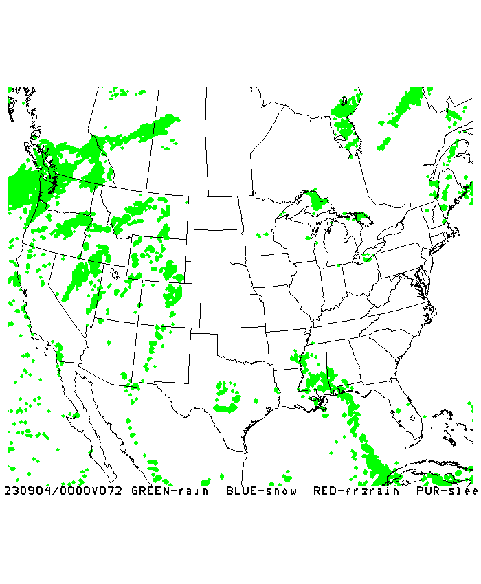