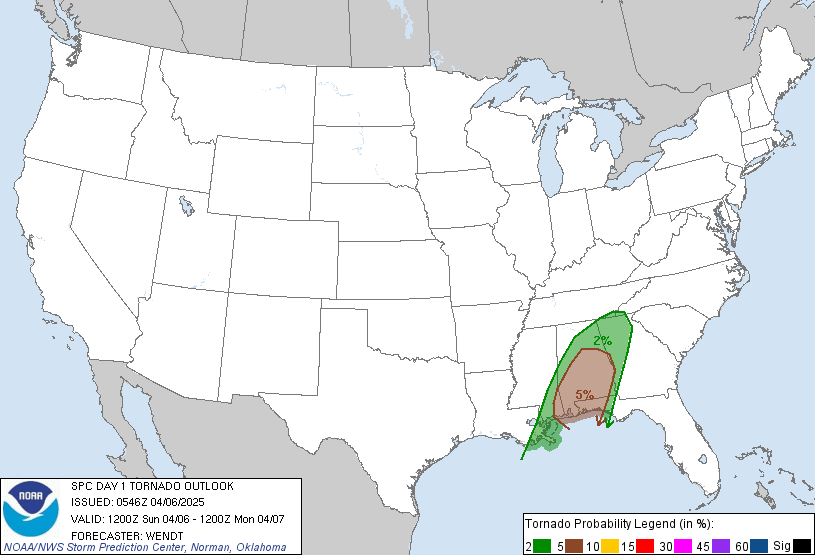
The SPC has come out with its latest graphic for tornado chances and possible locations:
This graphic may be updated early this afternoon.
But as you can see, most of the action should stay south near MS and AL. However, notice how the SPC has hatched areas near western KY, southern IL, and western TN. That should be associated with the actual low that will be tracking through the region. With so much cyclonic action and shear available, isolated tornadoes can easily spin up. Something to watch for.
I'm surprised by the number of preliminary tornado reports some have entered in the Severe Weather Poll beginning at 7:00 am edt today and ending at 7:00 am edt Saturday morning. Remember, this is for the entire U.S., not just KY.
My current thinking is that at least 20 preliminary tornado reports will be forthcoming from this system today and tonight. Severe weather will be a possibility across the state today. So, heads up and keep an eye to the sky. Then, at night, keep those weather radios in alert mode. Stay safe. We'll talk again.
MS
Subscribe to:
Post Comments (Atom)
Tornadoes on Easter Sunday
This is a worse case scenario. Tornadoes and flooded, blocked roadways making for great difficulties reaching residences affecting hard hit ...
-
Recently, I noticed that our days have now begun to shorten. However, our sunset here in Louisville still remains at 9:10pm edt. Starting th...
-
In July of this year, I did a segment about the latest sunsets in the eastern time zone. This corresponded nicely with the summer solstice a...
-
A 1 Temperature C Humidity F Heat Index 2 81 82 86.82 This is an Excel spreadsheet program. Fairly ...


No comments:
Post a Comment