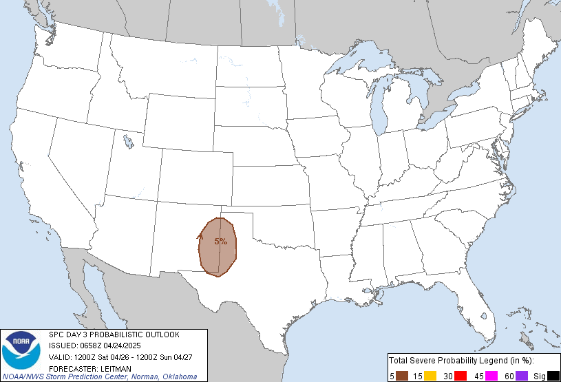
From the SPC: This pertains to Apr 8/9 time frame...
...OH VALLEY...
A SURFACE LOW ATTENDANT TO THE MIDWEST/OH VALLEY SHORTWAVE TROUGH
INITIALLY LOCATED OVER IL...AND AN ESEWD EXTENDING WARM FRONT...
WILL SHIFT EWD ON FRIDAY. THE SURFACE LOW SHOULD REACH ERN OH BY
09/00Z. LOW LEVEL SWLY FLOW WILL ADVECT MOISTURE INTO THE UPPER
OH/TN VALLEYS BENEATH AN EWD EXTENDING PLUME OF STEEP MIDLEVEL LAPSE
RATES WITH SURFACE DEWPOINTS IN THE LOWER 60S REACHING SRN OH/WRN WV
BY FRIDAY AFTERNOON. THIS COMBINED WITH SURFACE HEATING IS EXPECTED
TO SUPPORT A MODERATELY UNSTABLE WARM SECTOR. FORCING FOR ASCENT
WITH THE TRANSIENT SHORTWAVE TROUGH IS EXPECTED TO ALLOW TSTMS TO
DEVELOP FROM W-E ACROSS THE OH VALLEY WITH EFFECTIVE BULK SHEAR OF
40-45 KT RESULTING IN ORGANIZED STRONG TO SEVERE STORMS.
So far, it doesn't look like as widespread of an event than our previous one. But, I'll keep you updated. Thing to look for is how storms develop to our west as the storms appear to have a w-e orientation. Also, keep an eye on dewpoint, low-level jet, Lifted Indices, Mixed-Layer CAPE, Mid and Low-level Lapse rates, and freezing levels typically around 7,000-10,000 foot levels.
Nice day out there. Quite windy, though. Time to get back to the yard...
MS
Subscribe to:
Post Comments (Atom)
Tornadoes on Easter Sunday
This is a worse case scenario. Tornadoes and flooded, blocked roadways making for great difficulties reaching residences affecting hard hit ...
-
Recently, I noticed that our days have now begun to shorten. However, our sunset here in Louisville still remains at 9:10pm edt. Starting th...
-
In July of this year, I did a segment about the latest sunsets in the eastern time zone. This corresponded nicely with the summer solstice a...
-
A 1 Temperature C Humidity F Heat Index 2 81 82 86.82 This is an Excel spreadsheet program. Fairly ...


No comments:
Post a Comment