Good Saturday to all and welcome to the MikJournal. I'm still poring over data from last month and finding relevant information that pertains to our neck of the woods. It's been so busy around here lately. Now, with such tranquil weather conditions, I finally found time to do this. So here we go.
Here is an interesting statement from the National Climatic Data Center:
"In Kentucky, snowfall was well above normal for the second consecutive month with more than 12 inches (30.5 cm) of snow falling in the Bluegrass Region and eastern Kentucky. The back to back snowy winters of 2010 and 2011 are the snowiest in Kentucky since the snowy winters of 1977-1979."
That's quite a comparison!
Now, take a look at the overall departure from normal temperatures for the U.S. by clicking on the map below.
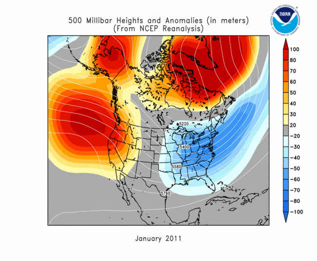
This next map really highlights the massive blocking patterns that provided the setup for our weather, locking us in with constant cold and snow.
The orange/red shaded areas represents ridging, which produced relatively warmer air for those nearby locations. But, the overall wind pattern around these ridges kept us in a cold fetch of air from Canada and points north, keeping us in a 'troughy' pattern as denoted by the blue shading.
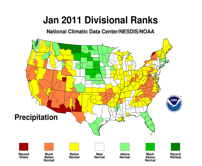
Finally, despite the snowy pattern that set in for most of us, January proved to be a very dry month for many. See how we compared with others with these next two maps.
This map shows that some recorded their driest January on record while others were not too far behind.
I still have yet more data to gather. But you know what? I'm going outside to enjoy today's weather. Hope you get a chance to do the same. Have a good day and thanks for visiting the MikJournal.
MS


No comments:
Post a Comment