For those who are curious about the type of weather one can expect on leap day, here's a couple of locations to think about...
Louisville KY:
Snowiest 2.2" 1912
Deepest Snow Cover 6" 1984
Wettest 0.31" 1952
Warmest Temperature 77 degrees 1972
Coldest Temperature 9 degrees 1884
Lexington KY:
Snowiest 0.5" 1996, 1968
Deepest Snow Cover 3" 1984, 1960
Wettest 0.38" 1908
Warmest Temperature 75 degrees 1972
Coldest Temperature 13 degrees 1960
Statistically, the above figures don't amount to very much. However, we have been in the grips of unusual and extreme weather patterns. I wouldn't be surprised to see a few of the above records for leap day be, well, leapt.
Now, let's talk about the various predictions out there. And believe me, there are a lot of `em,
First, the primary source of our forecasts, which comes from the National Oceanic and Atmospheric Administration (NOAA) and its National Weather Service. Here's what the NOAA page said last month...


Although, have you seen the latest 3-month forecast from the Climate Prediction Center (Dec-Feb)? Might want to check this out by clicking below...
Here are additional comments from the NOAA discussion...
Another part of the country that typically experiences wetter than average conditions during La Nina winters is the Ohio Valley. As you can see by the outlook map above, this winter is forecast to see above-average precipitation....While La Nina is not a major influence on weather in the Mid-Atlantic and Northeast, the Arctic Oscillation can be a big player. If the combination of enough cold air and moisture come together this winter, we could see above-average snowfall.
Next, one that some people skeptically look at, Farmers' Almanac. However, I think their forecast has a nice ring to it...

Now, let's take a look at another one, who has altered its forecast 3 times now. At least one of them is bound to be right, right? This is from The Weather Centre...


Here's an interesting one from Snow Day...with multiple revisions as well.


Their commentary is as follows...
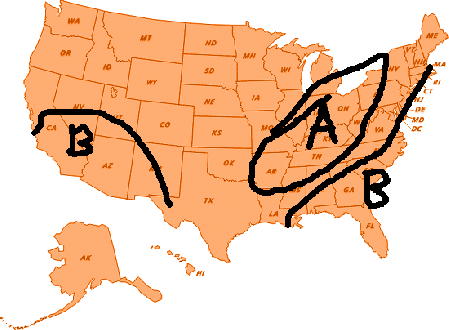
The second area of much above snowfall will exist from the Ohio Valley through the Great Lakes states and onward through the northeastern United States...I classify above average snowfall at least 5-10" above average and MUCH above average snowfall 10+" above average.
Due to the expected track of the storm systems this year, and the NAO for not being as negative as we head into the winter time as well as the AO being more neutral these storms will have a harder time to go as far south as last winter did, thus warm air will mix with the cold air creating the potential for significant ice storms across much of central and eastern Kansas through all of Missouri, northern Arkansas as well as all of Illinois western Kentucky and western and central Tennessee. This is when the storm system will track through Kansas and Missouri. The second storm track when the storms track through the Ohio Valley, typically this is ideal for a warm front to set up across the Carolinas and the Middle Atlantic States with ice storm risk before the warm front moves north changing everything to rain. This winter will be the winter of the Ice Storm over a good deal of the eastern/central United States.
Yet, another one from someone who I've seen on a few blog sites before, Mitch Gaines and his blog site http://mitchg.wordpress.com/
Temperatures

Precipitation
Snowfall

Well, in addition to the ones I've presented here, we in the community have our local weather heroes, who perform an outstanding service for our areas. They have even offered their insights into the winter of 2011/2012. Check them out at their respective blogs and facebook sites.
Also, don't forget to check out my official winter weather forecast by looking at the right hand side of my blog entitled MY 2011/2012 WINTER FORECAST
MS


No comments:
Post a Comment