Louisville's average temperature:
November 1 high - 65
November 1 low - 44
November 30 high - 51
November 30 low - 34
Highest November temperature: 85 degrees (set last year on November 1 and 2)
Lowest November temperature: -1 degrees in 1950 on November 25
Average total snowfall by November 30 - 0.2"
Highest snowfall total by November 30 (starting from July 1 beginning of snow year) - 13.2" (1966)
Sunrise/Sunset times
November 1 - 8:09am/6:43pm...10 hrs 34 min.
November 30 - 7:40am/5:23pm...9 hrs 43 min.
This is just data I like to provide to help you understand how much shorter are the daylight hours compared to last month. And the colder weather that often accompanies these shorter days.
Here is another interesting statistic: cloud cover
During the past couple of years, the months of January and February, which often contributes to a cold feeling day, have been the cloudiest here in Louisville. However, if we get a few days of solid cloud cover as a result of some inversion, which can happen this time of year, cold air can become trapped and take longer to burn off since the sun angle is so much lower.
Also, I have now included a couple more seasonal items on the side of the blog:
AER (atmospheric and environmental research) discusses the Arctic Oscillation, a significant player in the winter months.
Teleconnections shows a forecast at the 500mb level for other potential drivers/players of the winter season such as the EPO, NAO, PNA.
For the first part of November, I am still looking at a milder and wetter pattern compared to normal for our region at least through the 12th. Afterward, we might see another pattern change that may introduce colder air intrusions.
Weak La Nina is still expected for the upcoming winter season. However, weather patterns are different than last year about this time when a weak La Nina was about to commence. It's all about timing of weather systems and what drives them.
If we have many troughs that get cut off from the jet stream, weather systems will not be as progressive. However, last winter, our region was in a peak, or high point, while the west and northeast were in a valley, or low point.
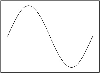
This winter, the progression of weather systems should put us in an upward slope. Depending on the amount of cold air and strength of weather systems, the sine wave could be compressed with lots of valleys and peaks resulting in numerous chances for precipitation in our region. Often, with compressed sine waves, we have stronger storm systems that typically 'warm us up' just before frontal passage and backside snows with the post-frontal passage.
What I am trying to say here is if you are a snow lover, stay tuned. An upward slope is what you want. If we can get just a normal system in here a few times this winter, I think many of us will be happy. The downside is that a stronger storm system follows a path that keeps the heaviest wintry precipitation to our west and north. That has happened here in our region several times over the years.
But, I'll focus more on that in a future post. Just whetting your appetite.
MS


No comments:
Post a Comment