If we're going to get in on any of the really cold air, it will be coming from these areas. Take a look:
Pay attention to these areas. Any southern advance could spell COLD for our area in the next couple of weeks.
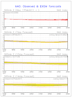
Hmm, as I'm posting this, the NAO Ensembles forecast went 'flatlined' on me. I guess the cold air 'killed' the computerized algorithms:
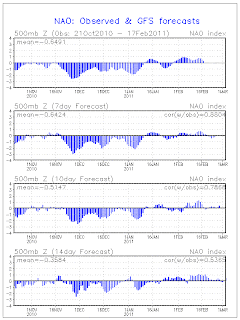
I'm sure this will be fixed momentarily. Here's another forecast chart, though.
Keep your eye on this one as the GFS forecast shows a little dip in the 7-day outlook. Could be a brief shot of colder air. We'll see. However, the overall pattern seems to be changing for the better (if you like less wintry conditions).
Also, keeping an eye on severe weather chances. Right now, the only severe weather threat appears to be, of all places, in the Bay area around San Francisco. A slight chance for tornadoes. Go figure.
I think severe weather chances will be going up within the next 7 days for some. Stay tuned.
In the meantime, enjoy your TGIF eve!
MS
Subscribe to:
Post Comments (Atom)
Tornadoes on Easter Sunday
This is a worse case scenario. Tornadoes and flooded, blocked roadways making for great difficulties reaching residences affecting hard hit ...
-
Recently, I noticed that our days have now begun to shorten. However, our sunset here in Louisville still remains at 9:10pm edt. Starting th...
-
In July of this year, I did a segment about the latest sunsets in the eastern time zone. This corresponded nicely with the summer solstice a...
-
A 1 Temperature C Humidity F Heat Index 2 81 82 86.82 This is an Excel spreadsheet program. Fairly ...


No comments:
Post a Comment