Tuesday, November 22, 2011

Just Another Day in Paradise (Mt Rainier)

Here are some webcam shots at and near the Paradise Jackson visitor center

Looking west at the road to Paradise from the Jackson Visitor Center.

A view of the Jackson Visitor Center at Paradise.

Snow amounts are really going to add up this week. Continue to check back for more updates on their winter Paradise.

MS

Monday, November 21, 2011

***SPECIAL*** Comparing The Winter Forecasts 2011/2012

There's not much time for your predictions about this winter. The beginning of meteorological winter begins December 1 and will end February 29 (leap day). Since this will be a leap year coming forth, I wonder how many professionals factored that extra day into their summaries? Hmm.

For those who are curious about the type of weather one can expect on leap day, here's a couple of locations to think about...

Louisville KY:
Snowiest 2.2" 1912
Deepest Snow Cover 6" 1984
Wettest 0.31" 1952
Warmest Temperature 77 degrees 1972
Coldest Temperature 9 degrees 1884

Lexington KY:
Snowiest 0.5" 1996, 1968
Deepest Snow Cover 3" 1984, 1960
Wettest 0.38" 1908
Warmest Temperature 75 degrees 1972
Coldest Temperature 13 degrees 1960

Statistically, the above figures don't amount to very much. However, we have been in the grips of unusual and extreme weather patterns. I wouldn't be surprised to see a few of the above records for leap day be, well, leapt.

Now, let's talk about the various predictions out there. And believe me, there are a lot of `em,

First, the primary source of our forecasts, which comes from the National Oceanic and Atmospheric Administration (NOAA) and its National Weather Service. Here's what the NOAA page said last month...


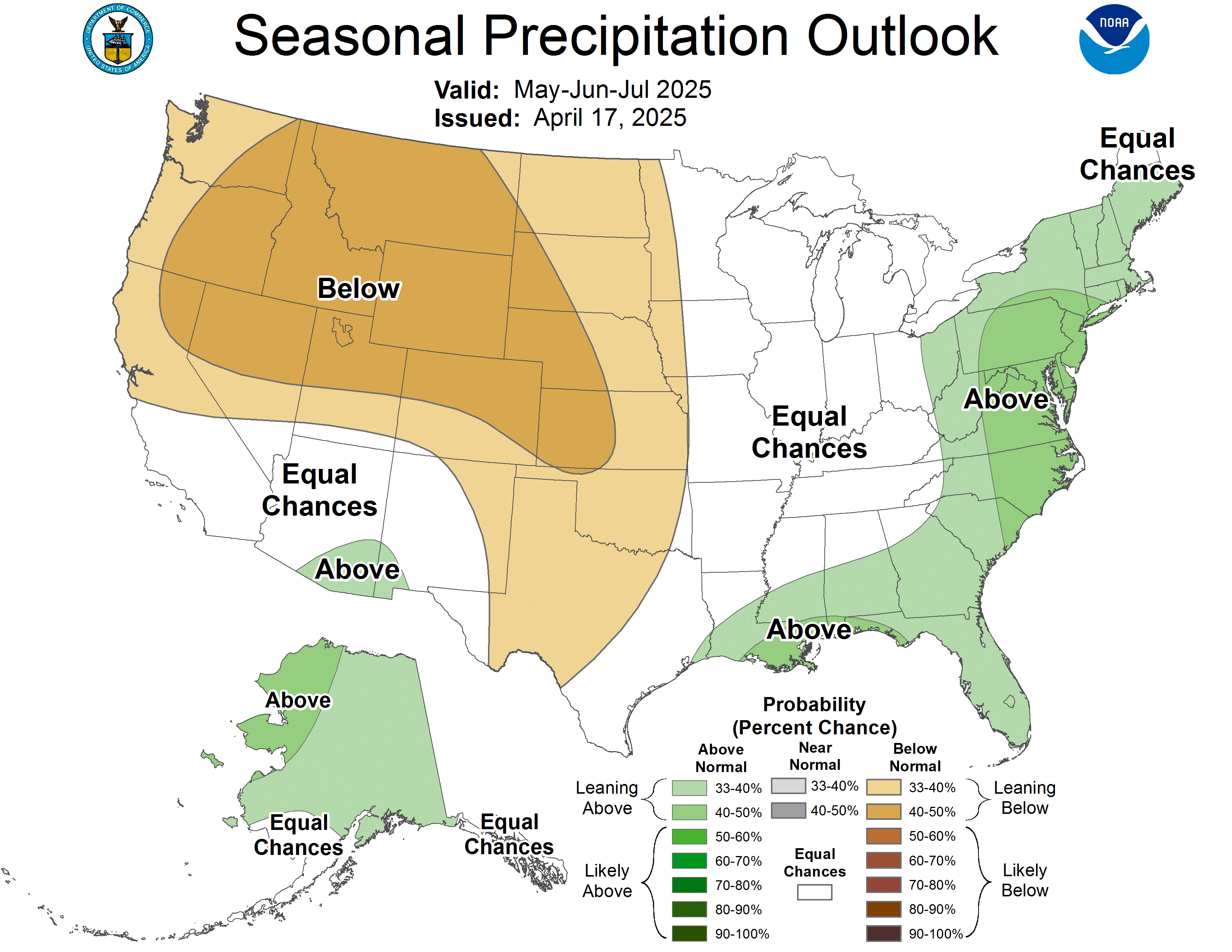
Although, have you seen the latest 3-month forecast from the Climate Prediction Center (Dec-Feb)? Might want to check this out by clicking below...

Here are additional comments from the NOAA discussion...
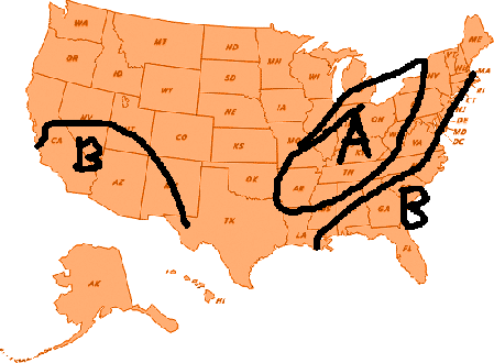
Another part of the country that typically experiences wetter than average conditions during La Nina winters is the Ohio Valley. As you can see by the outlook map above, this winter is forecast to see above-average precipitation....While La Nina is not a major influence on weather in the Mid-Atlantic and Northeast, the Arctic Oscillation can be a big player. If the combination of enough cold air and moisture come together this winter, we could see above-average snowfall.

Next, one that some people skeptically look at, Farmers' Almanac. However, I think their forecast has a nice ring to it...


Now, let's take a look at another one, who has altered its forecast 3 times now. At least one of them is bound to be right, right? This is from The Weather Centre...


Here's an interesting one from Snow Day...with multiple revisions as well.


Their commentary is as follows...

The second area of much above snowfall will exist from the Ohio Valley through the Great Lakes states and onward through the northeastern United States...I classify above average snowfall at least 5-10" above average and MUCH above average snowfall 10+" above average.

Due to the expected track of the storm systems this year, and the NAO for not being as negative as we head into the winter time as well as the AO being more neutral these storms will have a harder time to go as far south as last winter did, thus warm air will mix with the cold air creating the potential for significant ice storms across much of central and eastern Kansas through all of Missouri, northern Arkansas as well as all of Illinois western Kentucky and western and central Tennessee. This is when the storm system will track through Kansas and Missouri. The second storm track when the storms track through the Ohio Valley, typically this is ideal for a warm front to set up across the Carolinas and the Middle Atlantic States with ice storm risk before the warm front moves north changing everything to rain. This winter will be the winter of the Ice Storm over a good deal of the eastern/central United States.

Yet, another one from someone who I've seen on a few blog sites before, Mitch Gaines and his blog site http://mitchg.wordpress.com/

Temperatures


Precipitation


Snowfall


Well, in addition to the ones I've presented here, we in the community have our local weather heroes, who perform an outstanding service for our areas. They have even offered their insights into the winter of 2011/2012. Check them out at their respective blogs and facebook sites.

Also, don't forget to check out my official winter weather forecast by looking at the right hand side of my blog entitled MY 2011/2012 WINTER FORECAST

MS


Sunday, November 20, 2011

A Winter Paradise

In Washington state, not too far from the summit of Mt Rainier, at an elevation of nearly 5,500 feet is an area called Paradise. At the Ranger Station in Paradise, some of the heaviest snow amounts are recorded here on an annual basis, over 600" worth.

The snow season (for everybody) begins July 1 and ends June 30 each year. So far, since July, the Ranger Station has recorded 'just' 76.1". Of that total, 72" has occurred this month.

However, last year, snow amounts were more robust. In October 2010, 60.2" was recorded and 175" in November. In fact, last season's annual snow amounts from July 1 2010 to June 30 2011 amounted to a whopping 921"! A winter lover's paradise indeed.

Ironically, Paradise was not named for its winter pleasure but its beautiful views of Mt Rainier and the meadows of wildflowers.

Here's a quote from the National Park Service..."Paradise is famous for its glorious views and wildflower meadows. When James Longmire's daughter-in-law, Martha, first saw this site, she exclaimed, "Oh, what a paradise!"

A wildflower meadow at Paradise busy purple and red blooms and mountains  sits before a jagged mountain peak.

A storm system along the west coast is expected to stall and produce copious amounts of precipitation, especially in Washington. Snow, very heavy at times, is expected above the 5,000 foot level, including the Ranger Station at Paradise.

Here's a breakdown of the current forecast this week...

Tonight: Snow, mainly after 4am. Low around 19. West wind between 5 and 7 mph. Chance of precipitation is 80%. New snow accumulation of 1 to 3 inches possible.

Monday: Snow showers. High near 27. West wind between 5 and 9 mph. Chance of precipitation is 90%. New snow accumulation of 4 to 8 inches possible.

Monday Night: Snow. Low around 25. West southwest wind around 10 mph. Chance of precipitation is 90%. New snow accumulation of 10 to 14 inches possible.

Tuesday: Rain. Snow level 5300 feet. High near 33. Southwest wind between 8 and 14 mph. Chance of precipitation is 100%.

Tuesday Night: Snow. Low around 28. Chance of precipitation is 100%. New snow accumulation of 8 to 12 inches possible.

In addition, snow is expected every day through Saturday. This should help out the snow 'deficit' that's been ongoing for the past couple of months.

MS

Saturday, November 19, 2011

Earliest Sunsets in the Eastern Time Zone

In July of this year, I did a segment about the latest sunsets in the eastern time zone. This corresponded nicely with the summer solstice and the days that followed shortly afterward. Within the contigious United States, some locations in Michigan saw sunset times around 10:00 pm.

Well, it's that time of the year when the sun is setting earlier and earlier. Yes, the winter solstice is quickly approaching. Although December 22 will mark the shortest day of the year, it's noteworthy that sunset times are not always the earliest on this day.

First, here's the time zones of the United States...


Within the eastern time zone, Maine is the place to look at for the earliest sunsets.

Just as the sunset times may actually be later after the summer solstice, the earliest sunset times may actually occur well before the winter solstice, depending on where you are.

For example, Caribou's earliest sunset will occur on December 9 at 3:43pm. The sun will set at this time through December 14.

One of the earliest sunset times I could find in Maine occurs in Van Buren at 3:42pm, starting on December 7 through the 16th. I provided a partial listing of their sunset times during December below...

 
4
5
6
7
8
9
10
Sunrise: 7:00am
Sunrise: 7:01am
Sunrise: 7:02am
Sunrise: 7:03am
Sunrise: 7:04am
Sunrise: 7:05am
Sunrise: 7:06am
Sunset: 3:43pm
Sunset: 3:43pm
Sunset: 3:43pm
Sunset: 3:42pm
Sunset: 3:42pm
Sunset: 3:42pm
Sunset: 3:42pm

I found some honorable mentions in the Pacific Time Zone. Moyle Springs and Copeland ID share the earliest sunset time of 3:48pm right around December 12.

 MS

Friday, November 18, 2011

On This Day...Standard Time Zone System Adopted by U.S. and Canada

November 18, 1883. Not too many people think about this significant date in American history. However, this was the day that the U.S. and Canada adopted a system of time zones, primarily for railroad interests. It took quite a while for the general public to warm up to the idea, though.

I found this interesting read about the historical origins of standard time zones, and how Daylight Savings Time came to become so important.

Click HERE for the article.

MS

National Adoption Day November 19 2011

Kudos to WDRB for bringing this annual event to our attention: National Adoption Day.
In harmony with National Adoption Awareness Month, this special day was created to facilitate the finalization process for thousands of children awaiting adoption by self-sacrificing families and to raise awareness of the tens of thousands of children still awaiting to be included in a loving, permanent family arrangement.

This day is normally observed on the Saturday before Thanksgiving and is probably one of the most special days of the calendar year.

Here is the article from WDRB.com...
Save the Date: National Adoption Day Set for November 19

MS

You Know Winter Is Near...

Looking at the database of high temperatures for the U.S. yesterday, I could not find a location that exceeded 90 degrees.

The highest temperature I found was 88 at the North Perry Airport ASOS in Florida. California's highest temperature among reporting stations was 80 and Arizona's highest was 81. Hawaii's highest reported temperature was 85.

Yesterday's  lowest temperatures were found in Alaska again at -43 in Eielson AFB. In fact, 6 of the 54 reporting stations had low temps of -40 or lower. Fort Yukon was dethroned as the coldest but still reported -42.

On a different note, I really like paying attention to the daily temperature spread between highs and lows. It seems Alliance NE is a common location with the highest spread. Yesterday was no different. Alliance reported a high temperature of 60 degrees after an overnight low of just 6. In fact, Alliance almost reported the highest and lowest temperatures of reporting stations in the state of Nebraska. Chadron reported a high of 62, though, after an overnight low of 9.

Look at the reporting stations here in Nebraska

High

Low

Spread

State

Reporting Station

55

14

41

NE

AINSWORTH/MUNI

60

6

54

NE

ALLIANCE/MUNI

51

13

38

NE

AURORA

48

19

29

NE

BEATRICE_MUNICIPAL

52

19

33

NE

BREWSTER_FIELD_ARPT

51

10

41

NE

BROKEN_BOW_MUNI

62

9

53

NE

CHADRON/MUNI

55

12

43

NE

COLUMBUS_MUNI(AWOS)

52

8

44

NE

EVELYN SHARP FIELD

50

19

31

NE

FALLS CITY/BRENNER

50

21

29

NE

FREMONT_MUNI_ARPT

52

16

36

NE

GRAND ISLAND/HALL CO

52

17

35

NE

HASTINGS/MUNI

56

16

40

NE

IMPERIAL/MUNI

52

14

38

NE

KEARNEY_MUNI_(AWOS)

52

10

42

NE

LEXINGTON

50

15

35

NE

LINCOLN/MUNI

53

10

43

NE

MCCOOK/MUNI

50

14

36

NE

NORFOLK/STEFAN FLD

53

10

43

NE

NORTH PLATTE/LEE BIRD

57

10

47

NE

OGALALLA

49

21

28

NE

OMAHA/EPPLEY

49

20

29

NE

OMAHA/OFFUTT AFB

50

14

36

NE

O'NEILL/BAKER_FIELD

61

14

47

NE

SCOTTSBLUFF/CO

60

18

42

NE

SIDNEY/MUNI

50

15

35

NE

TEKAMAH (ASOS)

58

6

52

NE

VALENTINE/MILLER FLD


Alliance NE hourly readings...

17

16:53

Fair

CLR

51

60

50

17

14:53

Fair and Breezy

CLR

59

17

13:53

Fair and Breezy

CLR

60

17

12:53

Fair

CLR

57

17

11:53

Fair

CLR

53

17

10:53

Fair

CLR

50

50

6

17

9:53

Fair

CLR

45

17

8:53

Fair

CLR

38

17

7:53

Fair

CLR

28

17

6:53

Fair

CLR

16

17

5:53

Fair

CLR

14

17

4:53

Fair

CLR

10

13

7

17

3:53

Fair

CLR

11

17

2:53

Fair

CLR

10

17

1:53

Fair

CLR

9

17

0:53

Fair

CLR

9

16

23:53

Fair

CLR

9


Temperatures actually began rising during the overnight hours on the heels of warming south to southwest winds, even becoming quite gusty during the afternoon hours yesterday.

Something to keep in mind is that Alliance's reporting station is not an official reporting station but is often used in hourly weather observations regardless.

We have similar reporting stations like that here in Kentucky, such as Owensboro, Fort Knox, London. Do you know the official reporting stations in Kentucky?

MS

Tornadoes on Easter Sunday

This is a worse case scenario. Tornadoes and flooded, blocked roadways making for great difficulties reaching residences affecting hard hit ...