Well, it does not look like we are going to get much of a break from our recent pattern of wet weather. Already the HPC has been putting out 5-day totals exceeding 4" in our area (Louisville).
This Friday, Earth day, will be more like Water day, as our part of the earth will be covered by water. In case you're wondering, the record rainfall total for April 22 is 3.08" in Louisville. I really think we have a shot at breaking that 124-year old record if we get 'training' storms along the warm front.
This will only aggravate the regional flooding issues along the Ohio river and other smaller tributaries in southern Indiana.
In addition, chances for severe weather will be going up again. I'll be looking at that in another post. For now, expect the heavy rains not only for Friday, but well into next week, as some locations will be posting near record rainfall amounts for the month of April.
More later...
MS
Thursday, April 21, 2011

Wednesday, April 20, 2011
Confirmed Tornadoes for Apr 19-20 2011
I will be updating this page as NWS survey crews analyze storm damage from this storm system.
Two tornadoes confirmed in Jeffersonville. An EF-0 tornado briefly touched down damaging a shed, shingles, and trees alongs its 0.1 mile journey. Then perhaps the same vortex touched down again with EF-1 damage and wind speeds estimated at 80-90mph for 1.2 miles. A trailer roof was thrown 65 yards along with some 20-25 mobile homes damaged.
Remember the post below about tornadoes skipping? They cannot actually skip since they must be in constant contact with the ground and cloud base. Therefore, the survey crew made the right call by labeling these as 2 separate tornadoes despite the possibility that the same vortex caused the damage in Jeffersonville.
EF-0 tornado confirmed near Frankfort KY. Winds estimated at 65-70mph damaged shingles and several trees along its 4-mile trek.
EF-1 tornado in Oldham county KY. Again, a very brief touchdown, 0.2 mile path length. Just northwest of LaGrange, a barn was destroyed and roof damage at a house and another barn. 90 mph winds estimated.
EF-1 tornado in Simpson county KY near Franklin. 3.3 miles path length with estimated winds 90-95mph. 1 barn destroyed and the roof of another damaged. At least 100 trees uprooted or snapped.
EF-1 tornado in Scott county KY. Northeast of Georgetown, only traveled 0.5 miles with estimated winds 90-95mph. A tied-down trailer overturned, several outbuilding destroyed or damaged, and a garage wall collapsed.
EF-0 tornado in Harrison county IN. Just northeast of Corydon, 65 mph estimated wind speed snapped or uprooted several hardwood and softwood trees along its 0.3 mile journey.
EF-0 tornado in Breckinridge and Meade counties of KY. Along its 11-mile journey occasionally lifting at times, estimated 65-80mph winds destroyed a carport and then threw it across a field, trees snapped/uprooted, shingle damage to a home, and a barn door blown in.
Two tornadoes confirmed in Jeffersonville. An EF-0 tornado briefly touched down damaging a shed, shingles, and trees alongs its 0.1 mile journey. Then perhaps the same vortex touched down again with EF-1 damage and wind speeds estimated at 80-90mph for 1.2 miles. A trailer roof was thrown 65 yards along with some 20-25 mobile homes damaged.
Remember the post below about tornadoes skipping? They cannot actually skip since they must be in constant contact with the ground and cloud base. Therefore, the survey crew made the right call by labeling these as 2 separate tornadoes despite the possibility that the same vortex caused the damage in Jeffersonville.
EF-0 tornado confirmed near Frankfort KY. Winds estimated at 65-70mph damaged shingles and several trees along its 4-mile trek.
EF-1 tornado in Oldham county KY. Again, a very brief touchdown, 0.2 mile path length. Just northwest of LaGrange, a barn was destroyed and roof damage at a house and another barn. 90 mph winds estimated.
EF-1 tornado in Simpson county KY near Franklin. 3.3 miles path length with estimated winds 90-95mph. 1 barn destroyed and the roof of another damaged. At least 100 trees uprooted or snapped.
EF-1 tornado in Scott county KY. Northeast of Georgetown, only traveled 0.5 miles with estimated winds 90-95mph. A tied-down trailer overturned, several outbuilding destroyed or damaged, and a garage wall collapsed.
EF-0 tornado in Harrison county IN. Just northeast of Corydon, 65 mph estimated wind speed snapped or uprooted several hardwood and softwood trees along its 0.3 mile journey.
EF-0 tornado in Breckinridge and Meade counties of KY. Along its 11-mile journey occasionally lifting at times, estimated 65-80mph winds destroyed a carport and then threw it across a field, trees snapped/uprooted, shingle damage to a home, and a barn door blown in.
Tuesday, April 19, 2011
NOWCAST Severe Weather Outbreak Apr 19-20 2011
I will be posting some information here in anticipation of a possible severe weather outbreak for our region. So keep checking back for additional details.
***10:45pmUPDATE***
SPC has hatch marks near Louisville meaning strong tornadoes/destructive winds possible.
***8:00pm UPDATE***
NEW Tornado Watch issued for parts of Indiana, west KY. From just northeast of Indy southwest to Owensboro to Hopkinsville and points west of each location till 3:00am edt
In fact, this WATCH encompasses a lot of territory. I don't recall ever seeing a Tornado Watch so large.

***7:30pm UPDATE***
Possible tornado damage now reported in Girard IL where 2 homes damaged and people trapped
Incredible hail reports as well. Lots of golf ball size and larger being reported
Look for possible WATCHES to be issued for Louisville and points west within a couple of hours or so.
Timing of storms in Louisville as of now stands at about 1:00am edt or so. Storms not moving as fast at the moment.
***6:55pmUPDATE***
At least 1 home and 2 barns destroyed in Bowling Green MO
Some reports of softball size hail
In fact, lots of hail reports thus far
***6:10pm UPDATE***
Southern suburbs of Springfield IL watch out for severe weather.
Talk about a warm front; during a 5-hour stretch, Springfield went from 49 to 79 last hour.
-------------
***5:55pm UPDATE***
Have fun trying to get on the LIVE video chase cams
at severestudios.com and tornadoalley.net
------------------------
***5:30pm edt UPDATE***
First tornado warnings out north and west of St Louis
Golf ball to Baseball size hail reported with some of those cells.
SPC has placed hatch marks for greatest chance for strong tornadoes:
 I expect these storms to take on average of about 7-8 hours from now to enter Louisville area.
That would be about 12:30am or so. Please turn on those weather radios before going to bed.
----------------------------------
As of this post, a TORNADO WATCH has been posted for areas around St Louis.
For amateur (radio) weather spotters: here is a map depicting the proper repeater frequency
http://www.crh.noaa.gov/lmk/pdf/known_hamradio_repeater_map.pdf
***10:45pmUPDATE***
SPC has hatch marks near Louisville meaning strong tornadoes/destructive winds possible.
***8:00pm UPDATE***
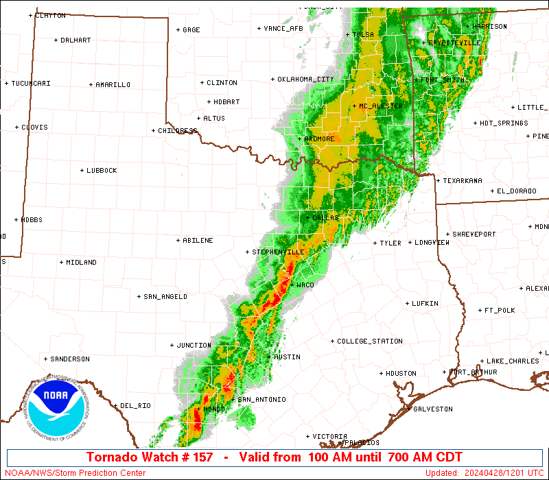
NEW Tornado Watch issued for parts of Indiana, west KY. From just northeast of Indy southwest to Owensboro to Hopkinsville and points west of each location till 3:00am edt
In fact, this WATCH encompasses a lot of territory. I don't recall ever seeing a Tornado Watch so large.
***7:30pm UPDATE***
Possible tornado damage now reported in Girard IL where 2 homes damaged and people trapped
Incredible hail reports as well. Lots of golf ball size and larger being reported
Look for possible WATCHES to be issued for Louisville and points west within a couple of hours or so.
Timing of storms in Louisville as of now stands at about 1:00am edt or so. Storms not moving as fast at the moment.
***6:55pmUPDATE***
At least 1 home and 2 barns destroyed in Bowling Green MO
Some reports of softball size hail
In fact, lots of hail reports thus far
***6:10pm UPDATE***
Southern suburbs of Springfield IL watch out for severe weather.
Talk about a warm front; during a 5-hour stretch, Springfield went from 49 to 79 last hour.
-------------
***5:55pm UPDATE***
Have fun trying to get on the LIVE video chase cams
at severestudios.com and tornadoalley.net
------------------------
***5:30pm edt UPDATE***
First tornado warnings out north and west of St Louis
Golf ball to Baseball size hail reported with some of those cells.
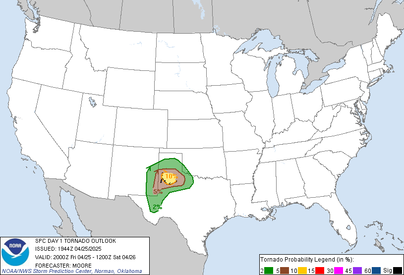
SPC has placed hatch marks for greatest chance for strong tornadoes:
That would be about 12:30am or so. Please turn on those weather radios before going to bed.
----------------------------------
As of this post, a TORNADO WATCH has been posted for areas around St Louis.
For amateur (radio) weather spotters: here is a map depicting the proper repeater frequency
http://www.crh.noaa.gov/lmk/pdf/known_hamradio_repeater_map.pdf
Pre-NOWCAST Updates
After this post, I'll be going into Nowcast mode, awaiting for storms to begin firing. Unfortunately, I won't be participating too much in the action later this evening and overnight as I'll actually be working my 'paid' job. However, will have an excellent view of things at Louisville International Airport.
Check out some of the temperatures, quite a contrast along that warm front. Just click on the image to enlarge.
 That warm front has also been an efficient producer of heavy rain, especially in the northern areas of our region. Here are some rainfall amounts since midnight.
 Awaiting the updated information from the SPC...and...
Just out...Still a MODERATE risk for severe storms across the region. Again, my thinking is that they are awaiting data that will help them determine when the Cap will begin to erode and where the best chance for severe weather, especially supercellular ones will occur. At that time, a HIGH risk and Potentially Dangerous Situation tornado watches may be forthcoming later this evening.
The SPC says:
IN A CORRIDOR OF ENHANCED LOW-LEVEL SHEAR FROM E-CNTRL MO EWD
THROUGH CNTRL PARTS OF IL/IND. GIVEN MORE DISCRETE STORM MODES
/I.E. SUPERCELLS/...THIS AREA WILL REPRESENT THE GREATEST RISK FOR
TORNADOES /SOME POSSIBLY STRONG/ FROM LATE THIS AFTERNOON INTO
TONIGHT. OTHERWISE...EXPECT THE DEVELOPMENT OF SUPERCELLS AND LINE
SEGMENTS ALONG COLD FRONT WITH EVENTUAL UPSCALE GROWTH INTO ONE OR
MULTIPLE MCSS/QLCSS. WIDESPREAD OCCURRENCES OF HAIL AND DAMAGING
WINDS /SOME SIGNIFICANT/ ARE EXPECTED ACROSS THE MODERATE RISK AREA
INTO EARLY WEDNESDAY DUE TO THE PRESENCE OF STEEP LAPSE RATES AND
THE WIDE...UNSTABLE WARM SECTOR.
I'll be going into Nowcast mode in my next post later today.
MS
Check out some of the temperatures, quite a contrast along that warm front. Just click on the image to enlarge.


Just out...Still a MODERATE risk for severe storms across the region. Again, my thinking is that they are awaiting data that will help them determine when the Cap will begin to erode and where the best chance for severe weather, especially supercellular ones will occur. At that time, a HIGH risk and Potentially Dangerous Situation tornado watches may be forthcoming later this evening.
The SPC says:
IN A CORRIDOR OF ENHANCED LOW-LEVEL SHEAR FROM E-CNTRL MO EWD
THROUGH CNTRL PARTS OF IL/IND. GIVEN MORE DISCRETE STORM MODES
/I.E. SUPERCELLS/...THIS AREA WILL REPRESENT THE GREATEST RISK FOR
TORNADOES /SOME POSSIBLY STRONG/ FROM LATE THIS AFTERNOON INTO
TONIGHT. OTHERWISE...EXPECT THE DEVELOPMENT OF SUPERCELLS AND LINE
SEGMENTS ALONG COLD FRONT WITH EVENTUAL UPSCALE GROWTH INTO ONE OR
MULTIPLE MCSS/QLCSS. WIDESPREAD OCCURRENCES OF HAIL AND DAMAGING
WINDS /SOME SIGNIFICANT/ ARE EXPECTED ACROSS THE MODERATE RISK AREA
INTO EARLY WEDNESDAY DUE TO THE PRESENCE OF STEEP LAPSE RATES AND
THE WIDE...UNSTABLE WARM SECTOR.
I'll be going into Nowcast mode in my next post later today.
MS
Keep an 'Eye' to the Sky
Check out the latest wording from the SPC:
AN INCREASING POTENTIAL FOR MORE WIDESPREAD DMGG
WIND/POSSIBLE DERECHO CONDITIONS ACROSS PARTS OF IL/IND/KY/TN
TONIGHT. THIS THREAT LIKELY WILL CONTINUE WELL INTO WED MORNING AS
BAND OF 60+ KT SWLY LLJ SWEEPS NEWD IN TANDEM WITH CONVECTIVE SYSTEM
ACROSS LWR TN AND OH RVR VLYS.
Another update will be due out between 12:30 and 1:00 pm edt.
Unfortunately, for many in our region, the advertised supercells and squall line will be arriving after dark according to the latest consensus. While it's always suggested to keep an eye to the sky for rapidly changing weather conditions, it is much more difficult at night.
That's why I, and the entire meteorological community, strongly urge everyone to purchase a weather radio. This will be your 'eye' to the sky, along with local media.
Weather radios that come with programmable SAME codes is preferred. Therefore, you can program only the counties you want the alert tones to sound for. I always suggest programming counties just to your west, northwest, and southwest (in addition to your own county), as this is where storms usually come from.
I have provided two links in the Miks Piks section of my blog that gives you the 6-digit SAME code for your county and any adjacent counties. They are entitled Kentucky SAME and Indiana SAME.
More updates in a future post...
MS
AN INCREASING POTENTIAL FOR MORE WIDESPREAD DMGG
WIND/POSSIBLE DERECHO CONDITIONS ACROSS PARTS OF IL/IND/KY/TN
TONIGHT. THIS THREAT LIKELY WILL CONTINUE WELL INTO WED MORNING AS
BAND OF 60+ KT SWLY LLJ SWEEPS NEWD IN TANDEM WITH CONVECTIVE SYSTEM
ACROSS LWR TN AND OH RVR VLYS.
Another update will be due out between 12:30 and 1:00 pm edt.
Unfortunately, for many in our region, the advertised supercells and squall line will be arriving after dark according to the latest consensus. While it's always suggested to keep an eye to the sky for rapidly changing weather conditions, it is much more difficult at night.
That's why I, and the entire meteorological community, strongly urge everyone to purchase a weather radio. This will be your 'eye' to the sky, along with local media.
Weather radios that come with programmable SAME codes is preferred. Therefore, you can program only the counties you want the alert tones to sound for. I always suggest programming counties just to your west, northwest, and southwest (in addition to your own county), as this is where storms usually come from.
I have provided two links in the Miks Piks section of my blog that gives you the 6-digit SAME code for your county and any adjacent counties. They are entitled Kentucky SAME and Indiana SAME.
More updates in a future post...
MS
Tornado Targets
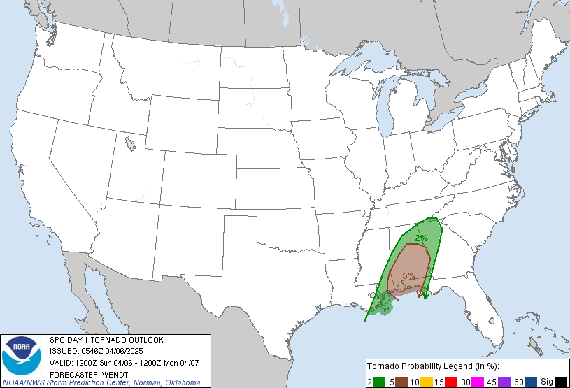
As of early this morning, here is the tornado risk for the region. Quite widespread as this encompasses a large chunk of real estate. I still think the SPC will place parts of the region in a 'HIGH' risk area for severe weather, especially western KY. Though with the expected Cap to be in place, they may want to wait and monitor the situation closely as the cap begins to erode and thunderstorms quickly fire.
TORNADO RISK
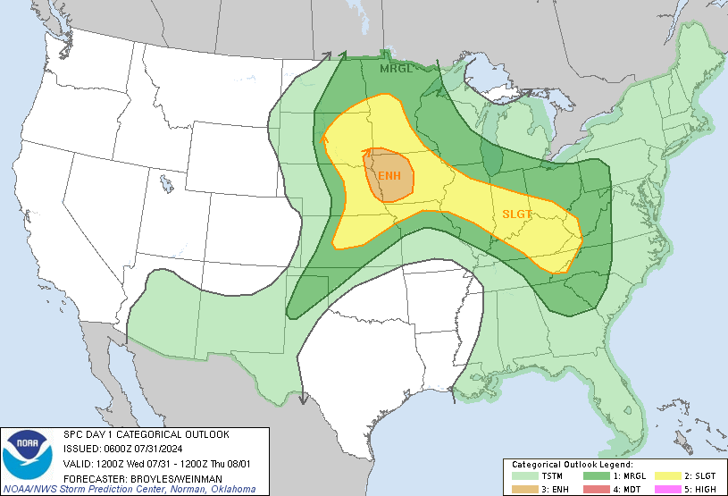
 And here is the overall severe weather threat for the region:
 Another update from the SPC should be out later this morning. Check back for further updates as this potentially dangerous system tracks our way!
MS
TORNADO RISK
MS
Monday, April 18, 2011
TORNADO SEASON - Do Tornadoes Skip???
As part of my interest in tornadoes and the significant damage they can cause, I've chosen to discuss some aspects of tornadoes that you may not have already known, or perhaps you already knew....
In this section, a question about tornadoes is, "Do tornadoes really skip?"
First, let's define what a tornado is:
"...in order for a vortex to be classified as a tornado, it must be in contact with the ground and the cloud base."
Therefore, in a literal sense, a tornado cannot really skip, since it must be in contact with the ground.
Stories of skipping tornadoes usually mean:
1) There was continuous contact between vortex and ground in the path, but it was too weak to do damage;
2) Multiple tornadoes happened; but there was no survey done to precisely separate their paths (very common before the 1970s);
3) There were multiple tornadoes with only short separation, but the survey erroneously classified them as one tornado.
(Thanks to Roger Edwards of the Severe Prediction Center)
I will be looking at our severe weather chances in the next post. Stay tuned. A MODERATE risk is already out there for the region. And as I said previously, some may go to a HIGH risk chance for the Tue-Wed time frame. Chance for storms tonight into tomorrow morning may bear watching as well.
MS
In this section, a question about tornadoes is, "Do tornadoes really skip?"
First, let's define what a tornado is:
"...in order for a vortex to be classified as a tornado, it must be in contact with the ground and the cloud base."
Therefore, in a literal sense, a tornado cannot really skip, since it must be in contact with the ground.
Stories of skipping tornadoes usually mean:
1) There was continuous contact between vortex and ground in the path, but it was too weak to do damage;
2) Multiple tornadoes happened; but there was no survey done to precisely separate their paths (very common before the 1970s);
3) There were multiple tornadoes with only short separation, but the survey erroneously classified them as one tornado.
(Thanks to Roger Edwards of the Severe Prediction Center)
I will be looking at our severe weather chances in the next post. Stay tuned. A MODERATE risk is already out there for the region. And as I said previously, some may go to a HIGH risk chance for the Tue-Wed time frame. Chance for storms tonight into tomorrow morning may bear watching as well.
MS
Subscribe to:
Posts (Atom)
-
Recently, I noticed that our days have now begun to shorten. However, our sunset here in Louisville still remains at 9:10pm edt. Starting th...
-
Although snow totals were a bit inflated for several locations by the different models, I still believe the amounts I had forecast were not ...
-
 In July of this year, I did a segment about the latest sunsets in the eastern time zone. This corresponded nicely with the summer solstice a...
