Every now and then, I check on some aspect of long-term forecasting to see how reliable such forecasts are, and if they are even worth considering. For example, for the month of February, I performed an analysis of the CPC's monthly forecast. I considered several random locations across the U.S., measured their monthly temps and precip against normal monthly values. Looking at the monthly forecast, I discovered that the CPC could have done better, but their forecast for the end of the month really helped their overall grade: C+
This month, I'll be looking at the CPC forecast for April. However, recently, I performed an analysis of the GFS Ensembles for 2m Temp Depart From Normal. On April 1, I looked at the Ensembles for April 2-12 and used Louisville, Indianapolis, Nashville, St Louis, Bowling Green, and Memphis for my analysis. I looked at all daily normal highs for each city during the period, considered the shaded regions indicating the departure from normal, and plugged in the actual highs against the forecast.
The results have been tallied. I thought that I was very generous in my grading process, especially since forecasting temps beyond 3 days can be very inaccurate. However, one notable problem I found with the ensembles during this time frame was the gross underestimation of above normal temps. The teleconnectors, NAO and PNA, both indicated above normal temps for this time period while the GFS ensembles mainly forecasted normal to below normal readings.
Here was a breakdown of the grades:
Louisville D
Indianapolis C
Nashville C+
Memphis B-
Bowling Green C
Overall grade for the region was: C
Again, I was very generous in the grading process. I would like to see the percentages come up just a bit. It could've been just a bad stretch. I will perform another analysis starting tomorrow, April 19, and run through the end of the month.
The teleconnectors I'm using, the NAO and PNA, are showing a cooldown toward the last part of the month. Possible below normal temps for a few days may occur. I'll see how the GFS Ensembles for 2m Temp Departures From Normal handle its forecast for this period...
I'll have updates on our impending severe weather chances this week soon. Plus, I'm going to discuss whether tornadoes 'skip' or not. Pretty interesting stuff. Come on back now, ya hear.
MS
Monday, April 18, 2011

Sunday, April 17, 2011
One More Round...Why Not.
After this past 3-day severe weather episode, can it get any worse? The death toll from this recent storm system has claimed at least 43 lives, mostly tornado-related. Preliminary tornado reports from the past two days were over 200. Some of those reports may be from the same tornado, though. Nevertheless, I believe the storm system 'peaked' in intensity as it crashed through NC and VA. One of the hardest hit areas was in Askewville NC in Bertie county. 10 fatalities and at least 50 injuries had been reported.
So, can it get any worse? Umm, maybe. The tornadoes are becoming stronger as we progress into this the tornado season. Please review the tornado safety tips in the Miks Piks section of my blog. Severe storms are already anticipated before midweek and we could be in the crosshairs this time. Now is the time to make preparation! Hats off to a quick-thinking manager at a Lowe's Home Improvement center in NC. While a tornado was bearing down on his store, which was ultimately flattened, he had gathered some 100 customers and employees to an area of the store free from flying glass and other debris. Last I had heard, there were no serious injuries, if any at all. He had already made preparations for the 'just-in-case' scenario. Now is the time for us to do the same.
I'll be talking about more tornado segments soon and will be closely watching the SPC's thoughts about impending severe weather for the upcoming week. Look for MODERATE chances and perhaps even a rare HIGH chance probability for severe weather in some areas. More large and long-track tornadoes are expected.
Whew. Time to catch a breath.
More updates later.
MS
So, can it get any worse? Umm, maybe. The tornadoes are becoming stronger as we progress into this the tornado season. Please review the tornado safety tips in the Miks Piks section of my blog. Severe storms are already anticipated before midweek and we could be in the crosshairs this time. Now is the time to make preparation! Hats off to a quick-thinking manager at a Lowe's Home Improvement center in NC. While a tornado was bearing down on his store, which was ultimately flattened, he had gathered some 100 customers and employees to an area of the store free from flying glass and other debris. Last I had heard, there were no serious injuries, if any at all. He had already made preparations for the 'just-in-case' scenario. Now is the time for us to do the same.
I'll be talking about more tornado segments soon and will be closely watching the SPC's thoughts about impending severe weather for the upcoming week. Look for MODERATE chances and perhaps even a rare HIGH chance probability for severe weather in some areas. More large and long-track tornadoes are expected.
Whew. Time to catch a breath.
More updates later.
MS
Saturday, April 16, 2011
Earth Day Coming This April 22 on Friday
Earth Day 2011 falls on a Friday this year, as always on the date April 22. I found a few community events you may be interested in that will be ongoing through the end of the month.
Camper Appreciation & Earth Day Celebration! Join us as we celebrate Earth Day and show our appreciation for our campers! Spend Friday night in the campground at regular price and get Saturday night FREE! Nature related activities will be provided all weekend long!Come on out and we will get the camping season started together!
Location: Rough River Dam State Resort Park, 450 Lodge Road, Falls of Rough, Kentucky
Date and time: Friday, April 29 through Sunday, May 1– 10:00 a.m. – 2:00 p.m.
Contact: Sheila Jones, (800) 325-1713, sheila.jones@ky.gov
Earth Day Festival - Louisville Zoo It’s a party for the planet to celebrate Earth Day! You can learn about the zoo’s conservation efforts and visit environmental displays by some of our eco- partners. $2 admission fee.
Location: Louisville Zoo, 1100 Trevilian Way, Louisville, Kentucky
Date and time: Saturday, April 23 – 10:00 a.m. – 5:00 p.m.
Contact: (502) 459-2181
6th Annual Garrard County Earth Day Festival TEACH, The Earth Angels and Community Hearth, Inc. 6th Annual Earth Day Festival
Location: Garrard County Fairgrounds, US 27, Lancaster, Kentucky 40444
Date and time: Saturday, April 30 – 10:00 a.m. – 5:00 p.m.
Contact: Leslie Worley (859) 548-5080
I never knew that Garrard County was where singer John Michael Montgomery shot his video "Sold" (The Grundy County Auction) in 1995.
Of course, it should not be that much of a surprise since JMM was born in nearby Danville in Boyle county.
The video was filmed at the stockyards, which has been closed since summer of 2007.
http://www.youtube.com/watch?v=oMxio_lrybM&feature=fvsr
Camper Appreciation & Earth Day Celebration! Join us as we celebrate Earth Day and show our appreciation for our campers! Spend Friday night in the campground at regular price and get Saturday night FREE! Nature related activities will be provided all weekend long!Come on out and we will get the camping season started together!
Location: Rough River Dam State Resort Park, 450 Lodge Road, Falls of Rough, Kentucky
Date and time: Friday, April 29 through Sunday, May 1– 10:00 a.m. – 2:00 p.m.
Contact: Sheila Jones, (800) 325-1713, sheila.jones@ky.gov
Earth Day Festival - Louisville Zoo It’s a party for the planet to celebrate Earth Day! You can learn about the zoo’s conservation efforts and visit environmental displays by some of our eco- partners. $2 admission fee.
Location: Louisville Zoo, 1100 Trevilian Way, Louisville, Kentucky
Date and time: Saturday, April 23 – 10:00 a.m. – 5:00 p.m.
Contact: (502) 459-2181
6th Annual Garrard County Earth Day Festival TEACH, The Earth Angels and Community Hearth, Inc. 6th Annual Earth Day Festival
Location: Garrard County Fairgrounds, US 27, Lancaster, Kentucky 40444
Date and time: Saturday, April 30 – 10:00 a.m. – 5:00 p.m.
Contact: Leslie Worley (859) 548-5080
I never knew that Garrard County was where singer John Michael Montgomery shot his video "Sold" (The Grundy County Auction) in 1995.
Of course, it should not be that much of a surprise since JMM was born in nearby Danville in Boyle county.
The video was filmed at the stockyards, which has been closed since summer of 2007.
http://www.youtube.com/watch?v=oMxio_lrybM&feature=fvsr
Friday, April 15, 2011
Tracking Severe Weather
Deja vu. Have we done this before? Another busy weather day as severe weather with tornadoes is expected. Even in parts of our region exists a possibility for tornadoes. Stay tuned to local weather media and your weather radios for the latest updates. Also, I'll be tracking any storms that may pose a risk to our region.
***6:10pm UPDATE***
Tennis ball size hail in McComb MS along with wind damage
So far, no confirmed fatalities with today's storms but about a dozen injuries, some serious.
Impressive line approaching western KY. Paducah, watch out!
***5:20pm UPDATE***
Severe T'storm Warning for St Louis
http://www.earthcam.com/usa/missouri/stlouis/kiener/
***5:10pm UPDATE***
Haven't heard or read anything yet, looks like 'hook' signature in McComb MS
We have 33 preliminary tornado reports so far today (since 7:00 am edt)
***4:50pm UPDATE***
Possible tornado near Meridian MS
Try this site in addition to severestudios:
http://www.tornadoalleylive.com/subindex/weather/maps
***3:55pm UPDATE***
Possible large tornado approaching Tuscaloosa AL
Severestudios web site must be pretty busy...can't get through at the moment.
***3:30pm UPDATE***
Here is a cool shot of satellite imagery from NWS Louisville
 Looking at the 'numbers' that support severe weather to our west, instability is increasing in west KY.
LI's approaching -5, while surface CAPES and MLCAPES increasing as well. Dewpoints on the rise...
 Dewpoint readings have approached the minimum 55-60 degree criteria that could support future tornadic cells in west KY. If anything, hail still looks like a good bet.
Check out http://www.severestudios.com/
***3:20pm UPDATE***
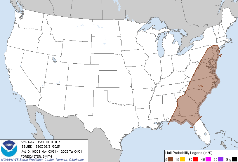
Here is the latest product from the SPC for HAIL chances
 As you can see, hail looks to be the primary threat with the system for west KY and TN and parts of MO and IL. However, the tornado threat still has not diminished. Tornadoes are still possible today for these areas.
***3:10pm UPDATE***
I'll be posting additional data about our severe weather chances. Storms are really firing nicely in Missouri and moving east. 23 preliminary reports of tornadoes today. Several warnings are still out. Expect it to get worse. 9 confirmed fatalities from OK and AR yesterday. Possibly 2 more reported today in MS.
***2:40pm UPDATE***
Check out http://www.severestudios.com/ for LIVE storm chasing. Cars flipped from apparent tornado in Clinton MS.

***2:13 pm UPDATE***
Cars flipped along I-20 near Jackson MS. Reports of fatalities
As of 2:00pm, 16 preliminary reports of tornadoes now.
***2:00 pm UPDATE***
New Tornado Watch box for Western KY
----------------------------------------
***1:30 UPDATE***
Apparent tornado barely misses elementary school in Clinton. No obvious damage to the school but trees across street have been snapped off and power is out at the school.
----------------------------------------
As of the 1:00 pm edt report, 10 preliminary reports of tornadoes have been received thus far, for those interested in their severe weather poll votes.
Jackson MS has sustained some tornado damage. More on that in a little bit.
Yazoo City MS may have escaped without one today. However, the threat is still there for now.
Light rain at my location with less than 0.20" so far. I'll be updating my thoughts on severe weather chances in a little bit as well.
MS
***6:10pm UPDATE***
Tennis ball size hail in McComb MS along with wind damage
So far, no confirmed fatalities with today's storms but about a dozen injuries, some serious.
Impressive line approaching western KY. Paducah, watch out!
***5:20pm UPDATE***
Severe T'storm Warning for St Louis
http://www.earthcam.com/usa/missouri/stlouis/kiener/
***5:10pm UPDATE***
Haven't heard or read anything yet, looks like 'hook' signature in McComb MS
We have 33 preliminary tornado reports so far today (since 7:00 am edt)
***4:50pm UPDATE***
Possible tornado near Meridian MS
Try this site in addition to severestudios:
http://www.tornadoalleylive.com/subindex/weather/maps
***3:55pm UPDATE***
Possible large tornado approaching Tuscaloosa AL
Severestudios web site must be pretty busy...can't get through at the moment.
***3:30pm UPDATE***
Here is a cool shot of satellite imagery from NWS Louisville

LI's approaching -5, while surface CAPES and MLCAPES increasing as well. Dewpoints on the rise...

Check out http://www.severestudios.com/
***3:20pm UPDATE***
Here is the latest product from the SPC for HAIL chances
***3:10pm UPDATE***
I'll be posting additional data about our severe weather chances. Storms are really firing nicely in Missouri and moving east. 23 preliminary reports of tornadoes today. Several warnings are still out. Expect it to get worse. 9 confirmed fatalities from OK and AR yesterday. Possibly 2 more reported today in MS.
***2:40pm UPDATE***
Check out http://www.severestudios.com/ for LIVE storm chasing. Cars flipped from apparent tornado in Clinton MS.
***2:13 pm UPDATE***
Cars flipped along I-20 near Jackson MS. Reports of fatalities
As of 2:00pm, 16 preliminary reports of tornadoes now.
***2:00 pm UPDATE***
New Tornado Watch box for Western KY
----------------------------------------
***1:30 UPDATE***
Apparent tornado barely misses elementary school in Clinton. No obvious damage to the school but trees across street have been snapped off and power is out at the school.
----------------------------------------
As of the 1:00 pm edt report, 10 preliminary reports of tornadoes have been received thus far, for those interested in their severe weather poll votes.
Jackson MS has sustained some tornado damage. More on that in a little bit.
Yazoo City MS may have escaped without one today. However, the threat is still there for now.
Light rain at my location with less than 0.20" so far. I'll be updating my thoughts on severe weather chances in a little bit as well.
MS
Tornado Threat For Some...
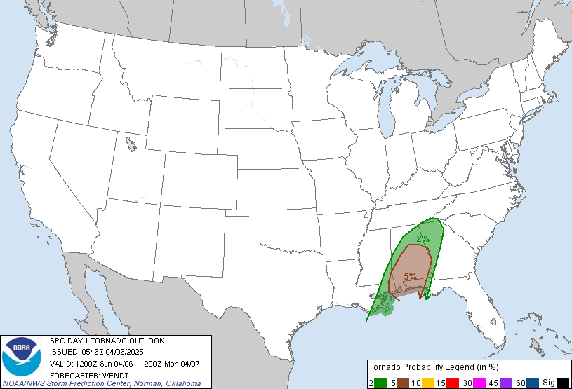
The SPC has come out with its latest graphic for tornado chances and possible locations:
 This graphic may be updated early this afternoon.
But as you can see, most of the action should stay south near MS and AL. However, notice how the SPC has hatched areas near western KY, southern IL, and western TN. That should be associated with the actual low that will be tracking through the region. With so much cyclonic action and shear available, isolated tornadoes can easily spin up. Something to watch for.
I'm surprised by the number of preliminary tornado reports some have entered in the Severe Weather Poll beginning at 7:00 am edt today and ending at 7:00 am edt Saturday morning. Remember, this is for the entire U.S., not just KY.
My current thinking is that at least 20 preliminary tornado reports will be forthcoming from this system today and tonight. Severe weather will be a possibility across the state today. So, heads up and keep an eye to the sky. Then, at night, keep those weather radios in alert mode. Stay safe. We'll talk again.
MS
But as you can see, most of the action should stay south near MS and AL. However, notice how the SPC has hatched areas near western KY, southern IL, and western TN. That should be associated with the actual low that will be tracking through the region. With so much cyclonic action and shear available, isolated tornadoes can easily spin up. Something to watch for.
I'm surprised by the number of preliminary tornado reports some have entered in the Severe Weather Poll beginning at 7:00 am edt today and ending at 7:00 am edt Saturday morning. Remember, this is for the entire U.S., not just KY.
My current thinking is that at least 20 preliminary tornado reports will be forthcoming from this system today and tonight. Severe weather will be a possibility across the state today. So, heads up and keep an eye to the sky. Then, at night, keep those weather radios in alert mode. Stay safe. We'll talk again.
MS
Thursday, April 14, 2011
Severe Weather Polls
Another significant tornado outbreak is in the developing stage. And all the action gets started today. Will this outbreak be as bad as some of the previous ones? What do you think? Here's your chance to chime in on what you think will happen.
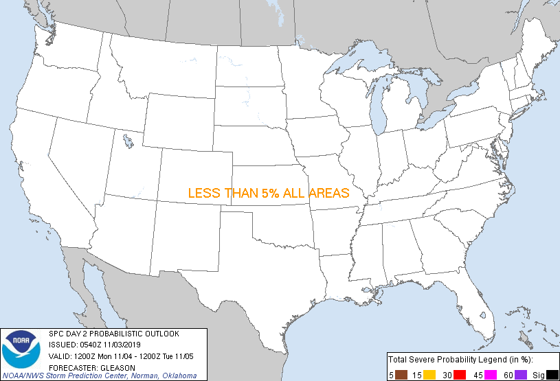
 As you can see, parts of the Gulf coast states are the primary targets on Friday, April 15. However, that does not mean that tornadoes will not occur outside of those areas. So, what do you think?
Therefore, SEVERE WEATHER POLL 1 asks "How many preliminary tornado reports will there be on Friday, April 15 2011?" The beginning of the poll actually occurs at 6:00 am cdt and ends exactly 24 hours later at 6:00 am cdt on Saturday, April 16. I will be using the SPC severe weather page that updates the preliminary count. You have until 6:00 am cdt or 7:00 am edt to submit your votes.
In addition, I have included a BONUS question that requires either a yes/no vote. Yazoo City MS has been hit by tornadoes within the past couple of years. During this upcoming possible outbreak, "Will Yazoo City see another tornado?" Again, submit your votes by 7:00 am edt on Friday, April 15.
More updates on our local weather coming soon...
MS
Therefore, SEVERE WEATHER POLL 1 asks "How many preliminary tornado reports will there be on Friday, April 15 2011?" The beginning of the poll actually occurs at 6:00 am cdt and ends exactly 24 hours later at 6:00 am cdt on Saturday, April 16. I will be using the SPC severe weather page that updates the preliminary count. You have until 6:00 am cdt or 7:00 am edt to submit your votes.
In addition, I have included a BONUS question that requires either a yes/no vote. Yazoo City MS has been hit by tornadoes within the past couple of years. During this upcoming possible outbreak, "Will Yazoo City see another tornado?" Again, submit your votes by 7:00 am edt on Friday, April 15.
More updates on our local weather coming soon...
MS
Wednesday, April 13, 2011
This Is TORNADO Season!
While tornadoes can occur at anytime of the year, most occur from April through June here in the U.S. In fact, during the past 3 years, an average of 803 actual tornadoes have occurred during these 3 months. Let's put that in perspective. So far this month, there have been 118 preliminary reports of tornadoes. Recently, even Kentucky has been plagued by numerous tornadoes already this year, a preliminary number of 27.
However, tornado season is really just getting started. It's important that people understand how to keep safe. In 2010, there were 45 tornado fatalities. Breaking that down while highlighting the most troublesome statistics, 20 of those fatalities occurred in mobile homes, 7 occurred in vehicles, and 6 occurred in the open or outside.
Already in 2011, 3 tornado fatalities have already occurred with 2 occurring in mobile homes, one in TN and the other in GA. While the other tornado fatality occurred in LA, each of the 3 tornadoes were rated an EF-2 on the Enhanced Fujita Scale.
***As part of Tornado Season, I'll be dedicating a significant portion of my blog to this powerful and dangerous weather event.***
I'll be discussing various aspects of tornadoes, but first and foremost that all should be made aware of is tornado safety. Flying Debris is the greatest danger in tornadoes. Please consult the following link in order to know how to remain safe before, during, and after a tornado touchdown.
Tornado Safety
http://www.spc.noaa.gov/faq/tornado/safety.html
As Tornado Season continues, I'll be posting links like this in the Miks Piks section of the blog. Remember, stay safe out there and get one of those weather radios!
MS
However, tornado season is really just getting started. It's important that people understand how to keep safe. In 2010, there were 45 tornado fatalities. Breaking that down while highlighting the most troublesome statistics, 20 of those fatalities occurred in mobile homes, 7 occurred in vehicles, and 6 occurred in the open or outside.
Already in 2011, 3 tornado fatalities have already occurred with 2 occurring in mobile homes, one in TN and the other in GA. While the other tornado fatality occurred in LA, each of the 3 tornadoes were rated an EF-2 on the Enhanced Fujita Scale.
***As part of Tornado Season, I'll be dedicating a significant portion of my blog to this powerful and dangerous weather event.***
I'll be discussing various aspects of tornadoes, but first and foremost that all should be made aware of is tornado safety. Flying Debris is the greatest danger in tornadoes. Please consult the following link in order to know how to remain safe before, during, and after a tornado touchdown.
Tornado Safety
http://www.spc.noaa.gov/faq/tornado/safety.html
As Tornado Season continues, I'll be posting links like this in the Miks Piks section of the blog. Remember, stay safe out there and get one of those weather radios!
MS
Subscribe to:
Posts (Atom)
-
Recently, I noticed that our days have now begun to shorten. However, our sunset here in Louisville still remains at 9:10pm edt. Starting th...
-
Although snow totals were a bit inflated for several locations by the different models, I still believe the amounts I had forecast were not ...
-
 In July of this year, I did a segment about the latest sunsets in the eastern time zone. This corresponded nicely with the summer solstice a...
